
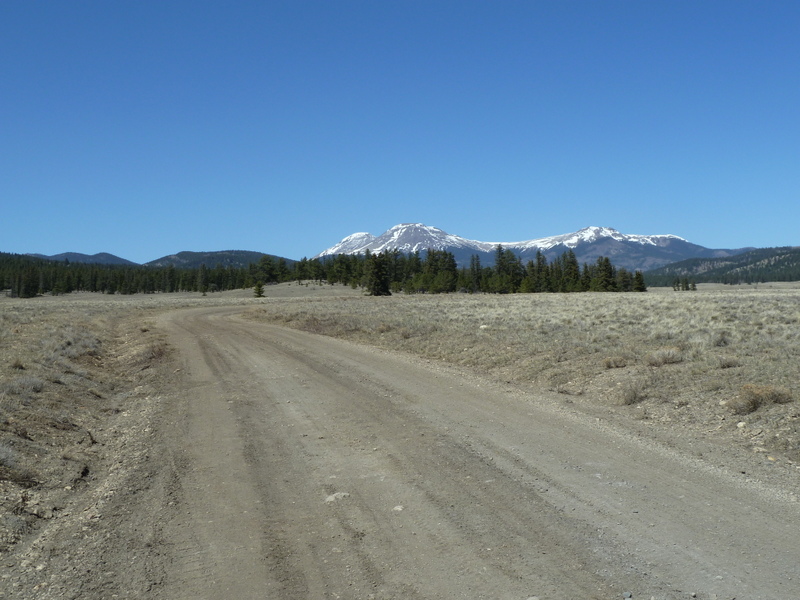
Riding up into Chubb Park toward the Buffalo Peaks.
We posted the GPX file from that Harvest Moon Ride, which happened WAY back in 2005, when we advertised the SBFL. But there were things about that route that were not ideal, so I've been meaning to buff it up a little and make it better. That means riding stuff and checking it out.
So I drew some lines on topos using TopoFusion, the state of the art in GPS software for mountain bike endorphin junkies. And I loaded some of those lines into my GPS and headed to Buena Vista to ride from town. From there I would ride up the very familiar Midland Trail, which is what I did with those Feier brothers all those years ago. But my plan this time was to ride up Shields Gulch to the Lenhardy Cutoff rather than jumping onto highway 24/285 like we did back in '05. I wanted to ride to Trout Creek Pass, and from there look for another route east toward Bassam Park and Aspen Ridge.
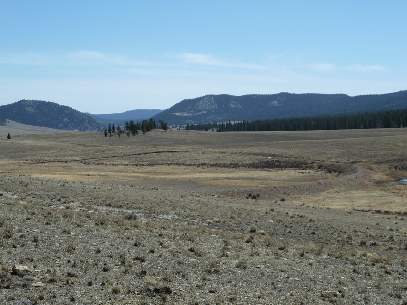
Here's where the Denver and South Park narrow guage line took a big turn out in the park to head back toward Trout Creek Pass, where it would cross out of the Arkansas River Basin into the South Platte Basin (aka South Park)
Of course the Midland Trail is based on a railroad grade, a 19th century one. There's so much I could say about how important the Denver and South Park Railroad was to the history of the Upper Arkansas, and then get into the rivalry between the Denver and Rio Grande and the D & SP... Some would be fascinated, others bored to tears. Suffice to say, the railroad ran their tracks from South Park over Trout Creek and into the Arkansas Valley, and then over into the Gunnison Valley after building the Alpine Tunnel. Interesting stuff, for those of us who are interested in such things.
But let's get back to my scouting trip. I rolled up Shields Gulch, turned right onto the Lenhardy Cutoff, and climbed to the pass over Limestone Ridge into Chubb Park. Then I pedaled up the nice gentle road in Chubb Park that heads up toward the Buffalo Peaks before turning back to the east to Trout Creek Pass.
My GPS had a track loaded that I had drawn which would (hopefully) take me southeast from Trout Creek, skirting the south edge of South Park and eventually turning west back up into the Arkansas Hills to meet with the original route.
Well, I got to Trout Creek and I was a couple hours into my trip; not fresh, but not crippled either. But the track I had drawn was not showing on my GPS' map screen. Confound it! I messed with the GPS quite a bit, standing by the side of a dirt road changing settings and pushing buttons (Geek!). Nothing helped.
So I started off in the direction I had remembered mapping, but soon came to an intersection that could have been right, could have been wrong. The obvious choice was how to get back to town: down. I decided I better just settle for a good bit of route recorded on the GPS and ready to go and a day well spent, and resolved to figure out why tracks were not showing up on my GPS map.
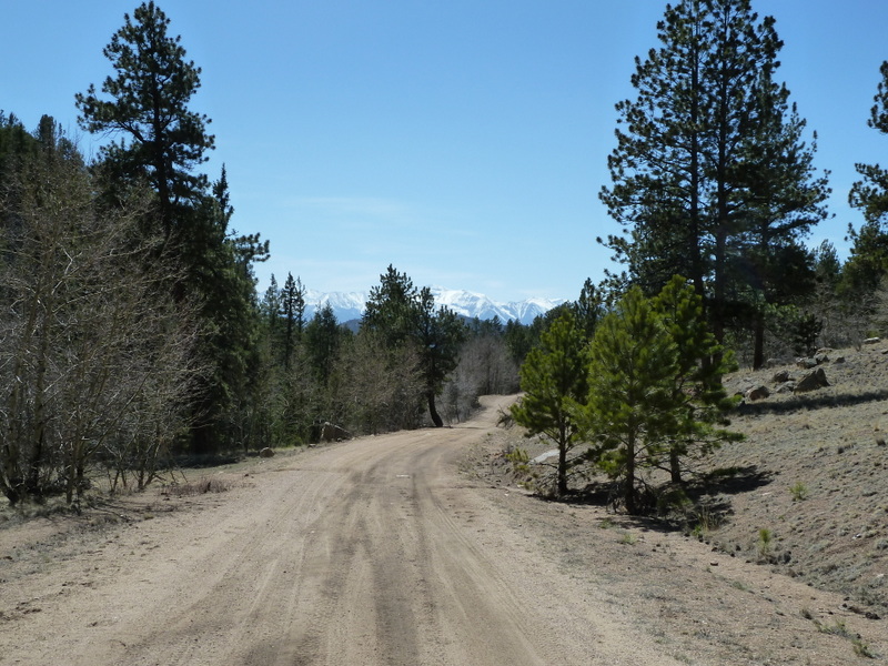
I was at the head of Mushroom Gulch, which I rode down and enjoyed quite a bit. Very pretty views west to the Sawatch.
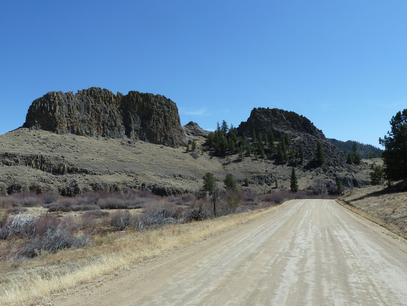
These beautiful rock formations with a lovely green sheen of lichen are called The Castles.
Nice ride. Back down to BV and home.
No comments:
Post a Comment