Monday, June 29, 2009

Summer Divide

Who could this character be?


Is it possible that he had something to do with the mysterious death of Michael Jackson?!


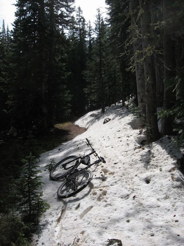
Sunday I followed a very non-creative strategy and rode pretty much the same ride I did last Sunday. I threw in one little wrinkle though, when I got to Marshall Pass I turned right and rode up the Monarch Crest Trail for a few miles to see what the snow-in-the-woods situaton was like up there.

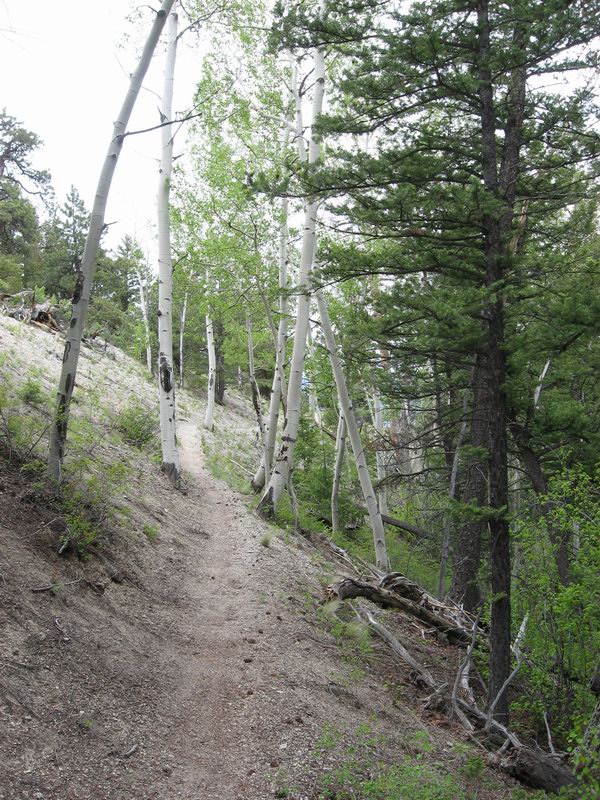
The Marshall Pass area is my favorite local hangout, and I really only see it for 5-6 months out of the year. All these scenes are woven into my life in Salida, and I do not really get tired of riding up there to look around.


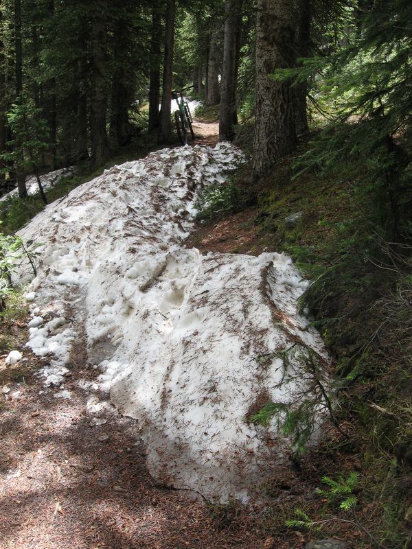
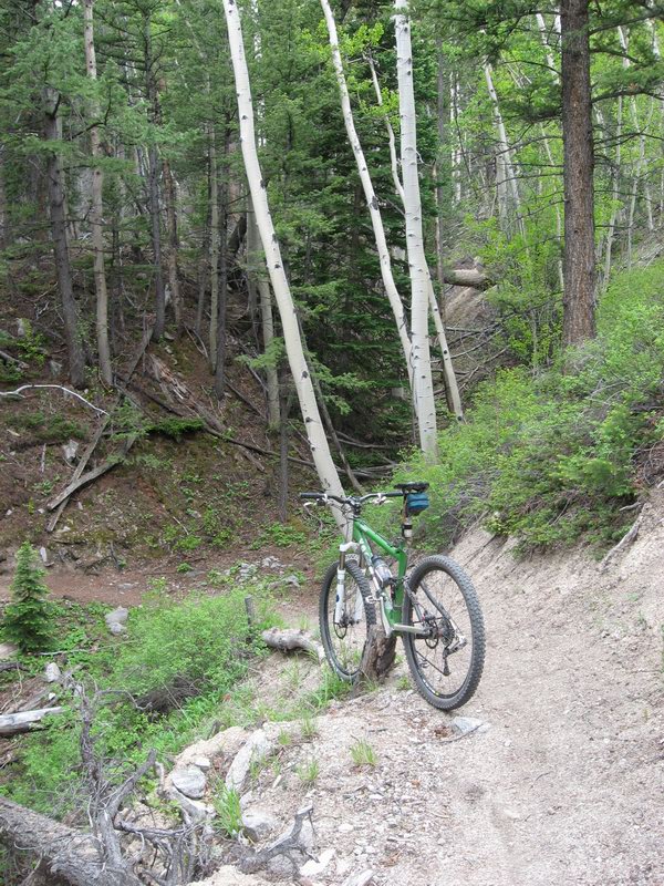
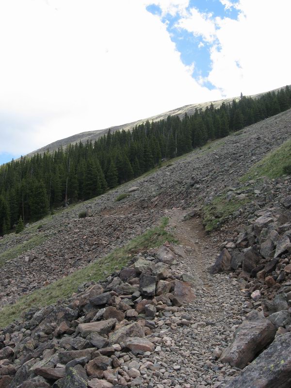
So there was some snow in the woods. I stamped and dug riding channels through a couple of mushy piles until my shoes and gloves were wet just to encourage people to stay on the trail. Then found some very muddy sections that people have been riding around anyway--nothing I could really do about that.

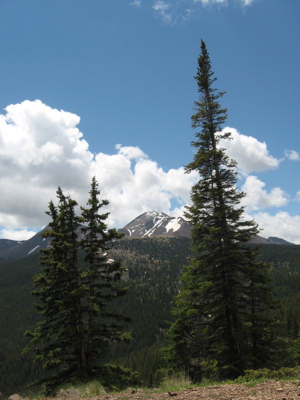
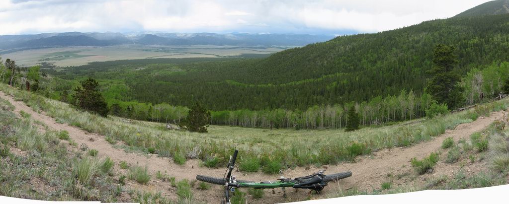
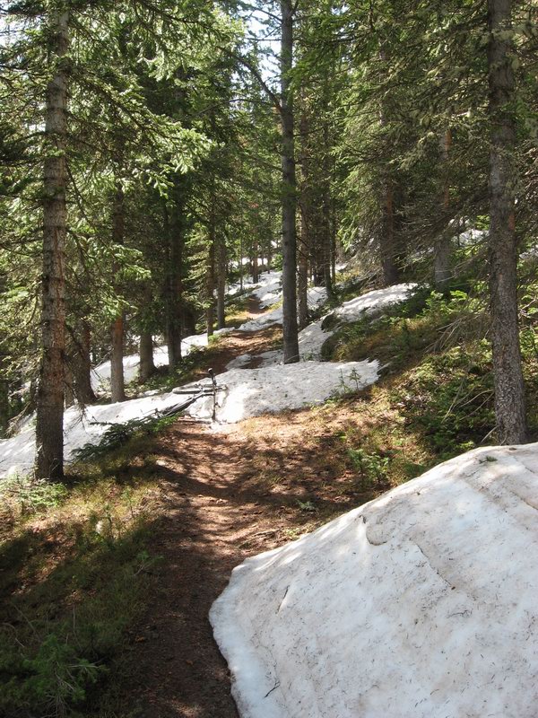
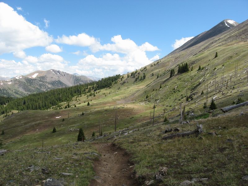
I went to the point where I could take the above photo, then turned around and rode back to Marshall and on to the Silver Creek Trail. I found this season's first pair of kind-of-lost out of town riders. They were carrying the inaccurate and vague freebie map that comes with the local mountain bike guide.

That stupid map--it's just amazing that after years of being told that the Rainbow Trail does not start at the CDT/Colorado Trail intersection they simply cannot figure out how to get it right. I've showed them, I've marked notes on the map and explained...

People have trouble finding the CDT/CT south from Marshall (the forest service has had confusing signs there since I first saw the Crest in the early 90's--also cannot get it right) then continue looking for "The Rainbow Trail". They come to a sign that says "Silver Creek Trail", pull out their crappy maps and say, "Jeez, this can't be it." Some continue on south, others give up and turn around, but many figure it out because at least the map shows that the trail they are looking for goes along next to Silver Creek.

If only these folks would spend $11.95 for a map that makes it all clear, they would be able to just focus on the ride without spending time trying to figure out the route.

It's a rich summertime tradition, finding groups of confused riders and explaining the way to them. I sometimes get riders who argue with me. I tell them, "I live here, I've been riding this for decades" and still they argue that the map doesn't show it that way.

Ah well, life is always interesting. At least I (usually) get to meet and assist some nice people during my trips up to the Divide.


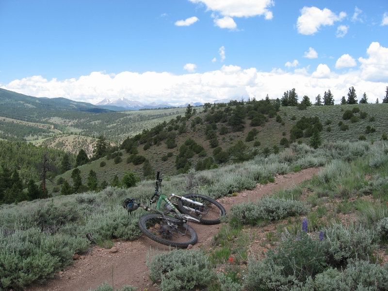
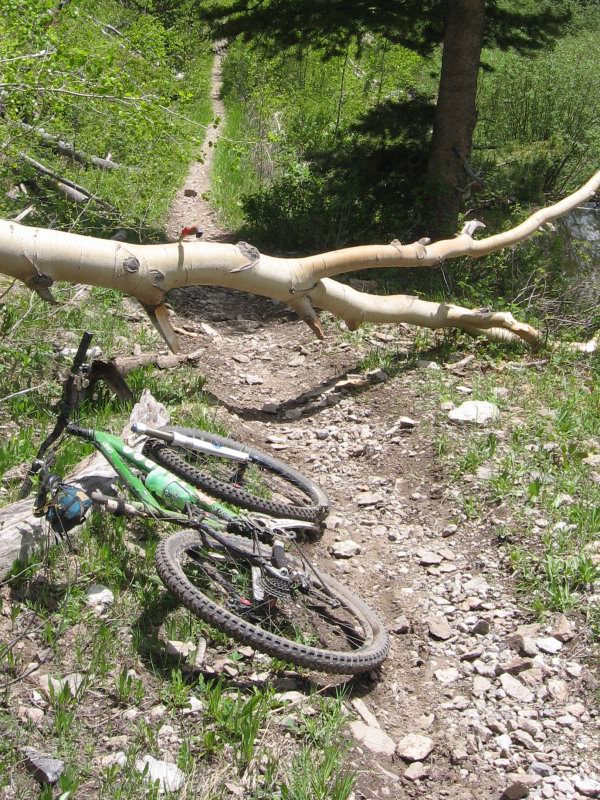
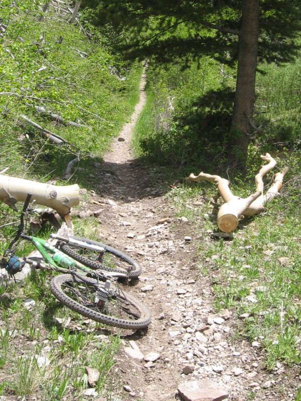
The Silver Creek Trail is a beautiful thing, then there's 11 miles of Rainbow. After decades of riding in this area, I do not get tired of that 1-2 punch.

Sunday, June 21, 2009

Snow and blow-downs

Got up to Marshall Pass for another recon, having heard that rumors that people have been soldiering through the melting snow and blow-down trees to get to the top of the Silver Creek Trail and ride that down to the Rainbow.

I felt that I deserved to share that experience.

Climbing to Marshall this morning was a challenge and a privilege. Nice brisk headwind up 285 toward Poncha Pass had me working it on the pavement. Then I hit the dirt Marshall Pass Road which was beautiful, cool, and green. It rained almost all day yesterday--so it was also mashed-potato mushy. It was work, but so nice to be up there!

I got to Marshall at about 10:30 AM. I headed south on the CDT, following some fresh dirtbike tracks. The dirt bikers came out to meet me as I was heading in. They seemed to have figured out that they were not supposed to be on the non-motorized trail. I didn't really say anything to them, I was just in too good a mood to bitch at them. They were heading back to the trailhead anyway, no biggy.

I got up into the trees and started seeing drifts.


This was the biggest one--mandatory walkover pretty much.

But most were on the decline. And unlike my last exploration, they were soft and melty. I took some time to stamp rideable lines into some of the ones that people were still going around.

Then I started encountering blow-down trees on the trail. No problem, I have my hand saw. I just cleared them as I went. I expected to find something that I needed a chainsaw for, but it never materialized.


Antora, south of the headwaters of Silver Creek. Still plenty of snow on it...

I stopped at the spot overlooking Silver Creek that I call the lunch spot and chowed down on some phewd, a Pro Bar, which I enjoyed thanks to the courtesy of a passing rep at the bike shop who left a whole box of them for us shop flunkies. They are pretty tasty! But free food always tastes the best.

Silver Creek Trail was really in hard shape. Very rutted, very rocky. It did NOT winter over very well. It's a really pretty trail, but man is it routed badly in many places. It's just too susceptable to erosion. Gonna be a rough ride this summer.

I kept up the tree clearing, though it wasn't nearly as big a deal as it was back in '07 when I cleared it. Just one log was chainsaw-worthy, but I got creative with the hand saw and got it out.


Pretty big aspen log for my little folding hand saw (see the little darling perched on top of my nemesis?


Afterwords, nice and clear.

The Rainbow was fast and tacky thanks to yesterday's rain. I was tired though. I was out there a long time with all the stopping to cut trees and all the free-Pro-Bar eating.

Great day. Consider Marshall Pass to Silver Creek open folks. By next weekend it should be pretty much dry.

Sunday, June 14, 2009

Colo Trail out and back to Salida

Took a ride from town up the start of the Vapor Trail to Blank's Cabin then north on the Colorado Trail. It's rugged and pretty, and has lots of good technical riding. And it's always snow-free early. When I got to Chalk Creek I got off the VT course and climbed up to the Mt Princeton Trailhead intending to go on to Cottonwood Creek then down to BV and home.


Canzo leaned on stump


Typical Colo Trail scene on east slope of Sawatch

As I got out onto the really nice section above BV, I started running low on calories, and thought the better of signing up for 35 miles of pavement to get home. My other option was to pick someplace to turn around, ride the CT back to the TH and then head back down to Chalk Creek and have only 20 pavement miles home. Sounds like a deal.


View from turnaround point

Late spring is heaven in the upper Arkansas Valley.

Friday, June 12, 2009

Up to the divide

I've been needing this. A long solo grind up to Marshall Pass, to look over to the Western Slope after getting to The Ridge under my own power. I've been honing in on bike fit setup on my new Hunter Cycles rigid "Adventure Touring" bike.


Close-up of the bike

Detail pictures of it clean can be seen at this prior post.

It took me a while to get there, well, like it always does. It's 3 hours if I'm really hittin' on all sixes. I've done it in 2:50, but I'm just not in that kind of fitness right now.

Also, I decided to set the Hunter up with thumbies, for the sake of total simplicity and reliability. But that kind of means 8-speed. I know, it can be done with 9-speed if you don't mind friction, which I don't. But I also like the durability of 8-speed.

Why does that have anything to do with how long it took me to get up there?

Gosh, it's kind of embarrassing...

I was between the gearing that I normally have going when I climb that. With 9-speed I get a 12-34 cluster (well, maybe 11-34, but that's not important). With the 34 I have mid-ring 1st gear 32:34, 2nd gear 32:30, 3rd gear 32:26. With a 12-32 block, it's 32:32, 32:28, 32:24.

I usually climb the first half in 3rd, 32:26 then slip to 2nd when the air gets thinner and my legs get tired. Well, 32:24 was too high and I couldn't really stay on top of it. But 32:28 was too low. Until I got tired and it was too high. I know, whining is unacceptable.

But I do know that with a load, 22:32 is going to be a not low enough granny. I wanted to use 20-30-42 chainrings on this bike, but I also wanted a Shimano crank with external bearings. I see Mr Whirly crankarms in my future.

I was really hoping to discover that the snow melt had happened enough that I could ride down the Silver Creek Trail. I headed south on the CDT to check it out.

Nope.


Those drifts were not soft. They were hard. I hit that section of trail at about 10 AM, and those suckers were hard as rock. Not much melt probably happened today. It just hasn't been getting very warm.

I went down the Poncha Creek road. Haven't done that kind of rock gauntlet on a fully rigid bike in many years. Ouch. How do you do that Ed? Pinch flatted, which was a good excuse to let my wrists and hands recover.

It's almost summer. Time for high country riding, snow or no.