Sunday, June 17, 2012

Visiting the High Lonesome


I'm carrying 5 stitches in my pinky finger, so I needed a ride that would be a little more mellow. And I've been wondering how the Continental Divide Trail north of the Alpine Tunnel is looking. Normally it would still be covered in snow, but of course this year is light.

I drove up to Mt Princeton Hot Springs and pedaled up the canyon to the Hancock Townsite.


I climbed up to Williams Pass...


Up and over to the west side of the Continental Divide.


Beautiful little cluster of columbine over on the west side.


Climbed back up to the west portal of the Alpine Tunnel, then hike-a-bike up to Altman Pass (the tunnel burrowed under Altman Pass).


So many beautiful vistas up there.


Palindrome number.


The last part of the CDT used to be a steep, mostly fall-line drop into the North Chalk Creek drainage. A dumping of hard-won elevation in a boring brake-burner. It's being re-routed, and the newly routed trail is a joy. Reminds me of the series of tight switchbacks at the end of the Reno-Flag-Bear ride near Crested Butte.


My flow was interrupted by surprisingly few down trees (considering what a problem blow-down has been this early season.

I pulled out the hand saw and clipped this one out.


Nice ride. What a dramatic trail!

Sunday, June 10, 2012

SBFL the day after

By most measures the Salida Big Friggin' Loop was a success. 58 riders started. As of right now I only have question about two riders' outcome. Lots of great stories coming out. Lots of Futurity Chips were returned to Salida.

Futurity Chips
All the original Futurity Chips in their hiding place

My day started out well. (That's forshadowing--nobody talks about how their day started well if it also ended well).

I got riders signed in down at Cafe Dawn and gave them their little pep talk. Then it was 6:30 AM and I told them to leave. I settled a couple things after the bulk of the riders left, then started my own ride at about 6:35. It was a nice relief from all the stimulation of planning and getting the whole thing going to just be on my bike, pedaling. I found my own pace and focused on doing what needs to be done to finish a really long ride.

It was going great. It was getting warm early, but I felt good and I was keeping up on eating and hydration. I was moving quickly, but without taking any crazy chances.

I was just near the end of the first section of the Colorado Trail, descending the steep and tight switchbacks down into the Chalk Creek drainage. Those switchbacks are pretty treacherous, and I was being careful.

I was turning left into one of the last serious ones, paying close attention to what my front wheel was doing. A stick attached to a blowdown log was extending into the trail and I failed to notice as my right hand hit it. The stick pinched my pinky finger hard against my handlebar. At first it really seemed like it was just an annoyance. I said, "ouch, that kind of hurt" as I stopped to look at it. I turned my hand and looked at it, and there was already blood coming through the fabric of my glove. I was surprised because it didn't seem like it could have been that bad. I took the glove off and the wound yawned open and blood started pouring down my hand onto the dirt.

I said, "Oh man! I'm out! Crap!"

Rather than embed the potentially nauseating photos of the wound and the stitches that I got, I put them on this page. Look if you want, but you can probably imagine what it looks like if you'd rather not see:

graphic images of my mangled pinky

So, Kathy came to get me after I called her on my cell. We went to the emergency room in Salida. I got stitches.

I'm disappointed obviously. I was really into doing more than just planning and hosting the SBFL. I wanted to finish it. And I was really in good shape to succeed.

But it didn't happen.

As always in these situations, it's a good idea to consider how much worse things could have been. I did not break bones. In fact, it's a fairly superficial wound and I should be able to ride pretty soon. Probably I could ride on the road today. And I got a chance to hang out at the finish, and go out to dinner with some of the cool people who came to take part.

It's OK. Like The Dude says, "Strikes and Gutters."

Thursday, June 7, 2012

My Big Friggin' Ambition

Today is Thursday, June 7, 2012. Saturday is June 9, and Saturday is also the Salida Big Friggin' Loop, a wholly-owned subsidiary of the Colorado Endurance Series.

dawn Colorado Trail
Colorado Trail near Mt Shavano at dawn, where my hosted friends should be passing by 9 AM or thereabouts.

I am hosting this event. Which means I'm the person who designed the route(s) and published the GPX files for them. I'm the person who will stand on a chair at 6:00 AM on Saturday morning to tell a gathering of endorphin junkies about what to expect and how to sign in their time if and when they return to Salida after riding a big circle around our lovely little valley. I am also the person who custom-crafted and planted fifteen little tokens in a ghost town 20+ miles from here so that 15 lucky peoples will be able to scavenger hunt them down and have one to keep for all time (or sell on the open market, as they are certainly destined to become valuable collectables).

The Colorado Endurance series Grand Poobah, Matt, approached me about hosting an event in June back last winter when I was working on a fat layer that would ultimately send me to the pants store to buy some bigger pants. In 2011 I had the worst year for endurance fitness since probably 2002, thanks to working at a 40-hour desk job and developing an odd knee problem that kept me from comfortably pedaling for more than about 2 hours on any given day. So in December when this plan was hatched I assumed that on the day of the event I would get up early, go stand on my chair for a while, then eat three or four large pastries and retire to my couch, exhausted.

Some time late in the winter or early in the Spring I decided that I might as well put my own name on the registration list and make at least a lame effort to be fit enough to make it to BV where I would eat my four large pastries then hitchhike home to my couch.

A funny thing happened though. As the spring progressed I found that my knee problem was gone. I committed myself to commuting to work (50 mile round trip) at least 5 or 6 times per month. And I took a look back into my memory banks to see if I could find any lost knowledge about how to build endurance out of a block of lard.

I'm happy to report that today, less than 48 hours before my date with that chair, I'm in OK shape. I've done several 50+ mile rides, some of them with a fairly nauseating amount of elevation gain. I have ridden to work quite a few times. I haven't yet graduated back to my old pants, but my new big-boy pants are a little more loose.

And I'm actually entertaining a certain amount of hope that I might be able to finish one of the two of my silly loops. I'm bringing a light, because the stars might be coming out by the time I roll down Ute Trail into town, but I'm going to take a shot.

Wish me luck.


Saturday, June 2, 2012

My Happy Place

silver creek
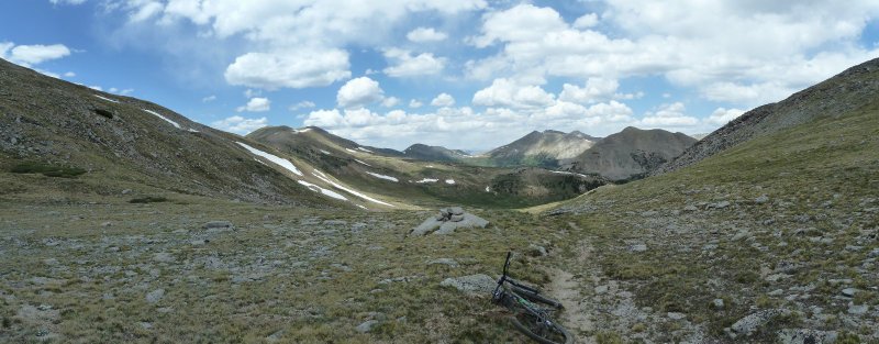
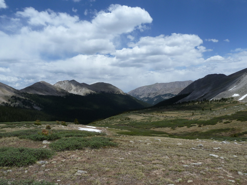
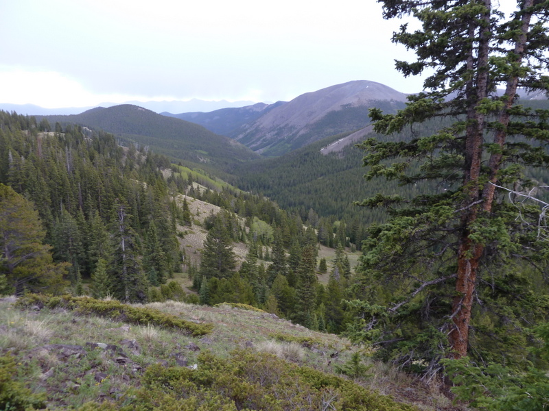
The Silver Creek Drainage as seen from the Continental Divide

When I first moved to Salida I spent lots of time up on Methodist Mountain, right south of town riding a trail that overlooked Salida. 
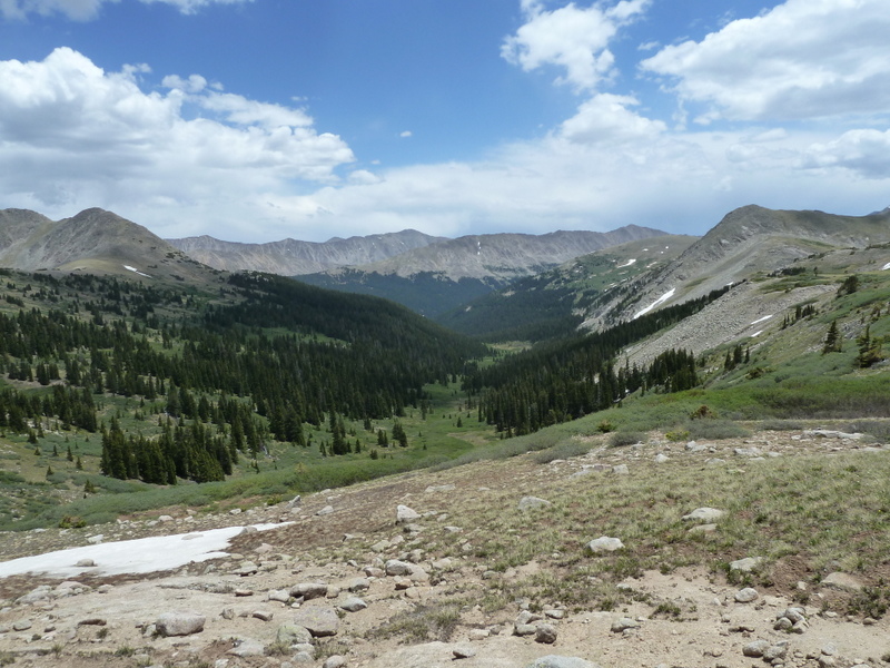
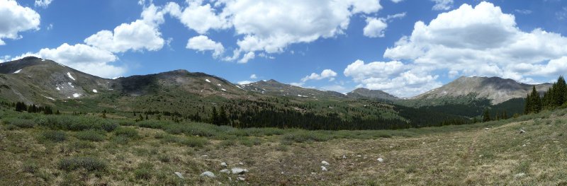
When my horizons expanded, I found that the basin of drainages that flow east from the Continental Divide in the Shadow of Mt Ouray was a magical place. Poncha Creek, Starvation Creek, Silver Creek. The minor drainages: Grays Creek, Tent Creek, Ouray Creek...

My happy place.

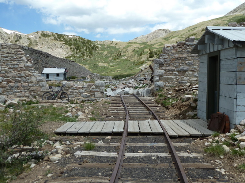
The Marshall Pass Road was the narrow gauge railroad route that Otto Mears designed to gain access to the mining towns in the Gunnison Valley. Now it's a dirt road, County Road 200. It's a steady middle-ring climb into my happy place.

As my pattern of behavior has established itself over the years I've been finding myself venturing up into this country, testing the water, every year in May and June. After I've established that the snow is gone, I make as many trips up as I can arrange in June through October. Then at some point in the autumn a series of storms will drift the snow in, and my preferred method of entering my happy place will be rendered invalid. And I won't see it again until May...

At some point I may not be able to leave this world alone from November through April, and I'll have to figure out how to haul my butt in using snowshoes or skis. But the rolling wheel is my drug of choice. As of today, my practice is to leave that country to my imagination during the cold months when I can't ride there.

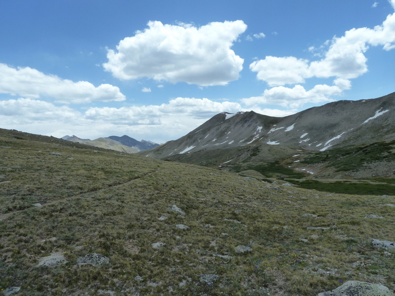
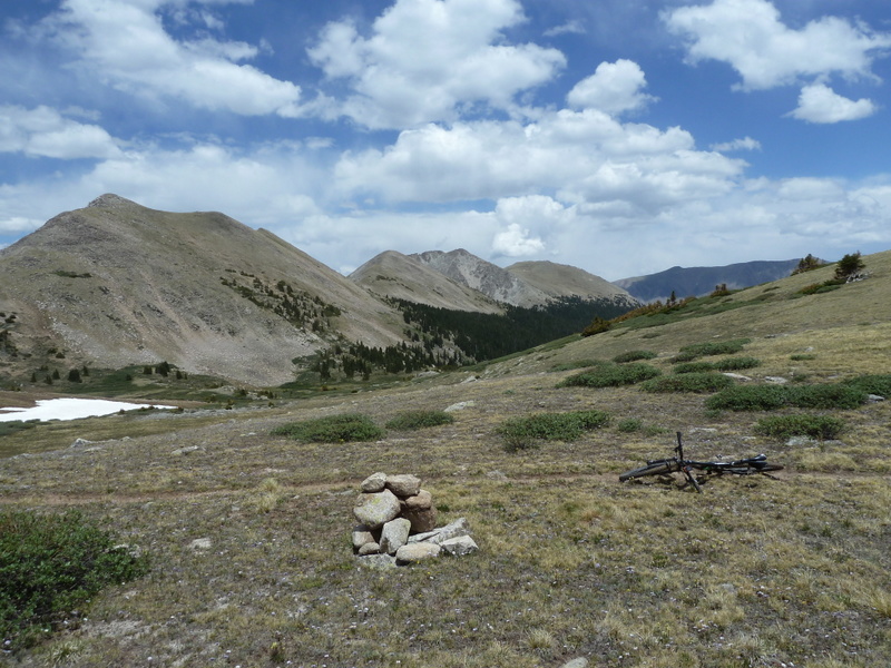
In all the late springs of this last decade I have had the distinct pleasure of returning to my happy place after a period of absence. Today I made the trip up to Marshall Pass, the traverse of the Continental Divide over to the headwaters of Silver Creek, and down. What a pleasure. What a magical thing that the combination of my body and bicycle can take me there.

To my happy place.
  marshall pass road

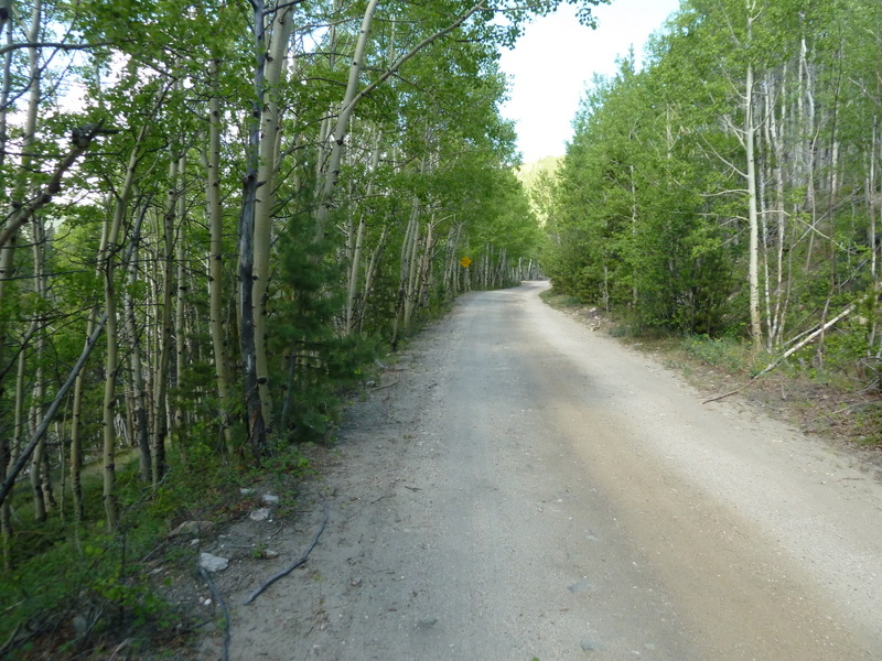
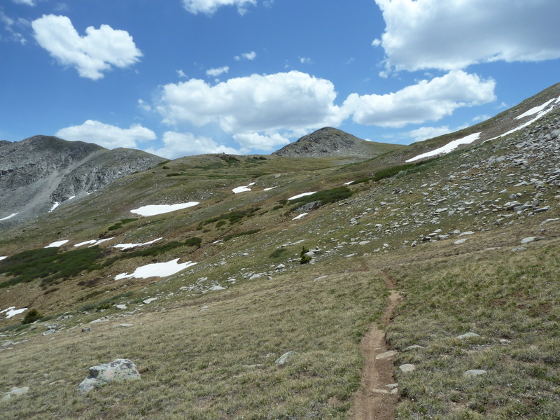
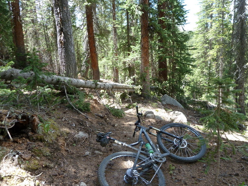
The journey begins by rolling up the road; out of the sage and pinon juniper and into the ponderosa pine. Then the ponderosa forest gives way to aspen-fir forest. The road at times passes through long stretches of classic Colorado aspen forest.
  stormy

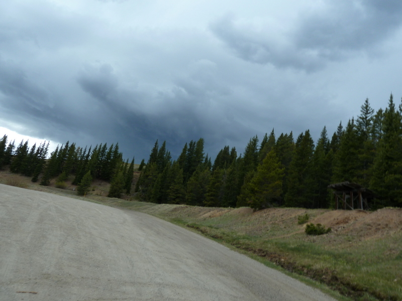
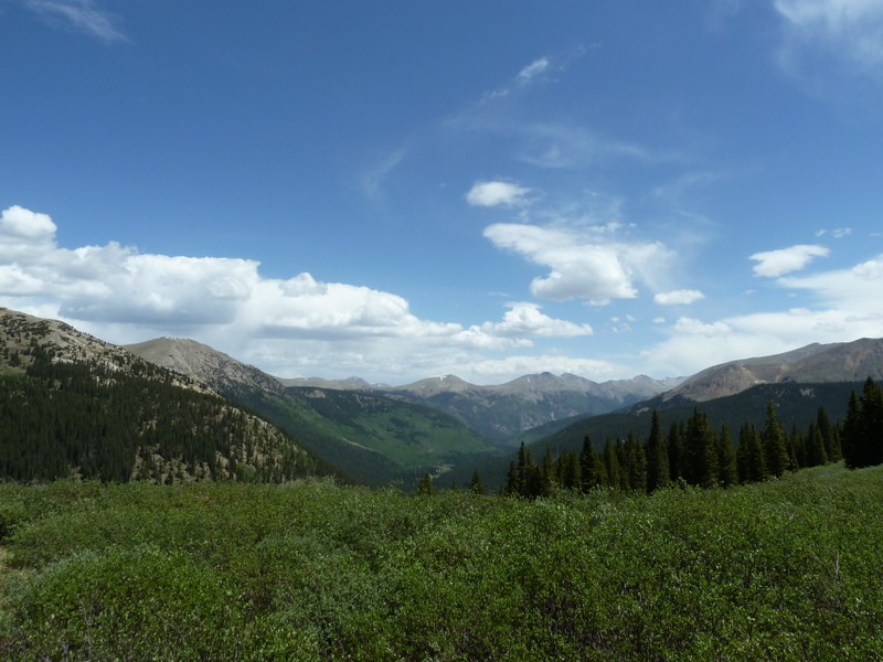
Saturday, June 2, 2012 was a beautiful sunny morning in Salida. It continued to be a beautiful sunny morning on up the road through the aspen, but as I approached Marshall Pass I became aware of a storm. It was early, just after 10 AM, but clearly a storm was brewing over on the western side of the divide. I took the above picture without stopping my pedaling. I was riding no-hands with a camera in my hands because I didn't want to lose any time.

I hoped to be able to scoot over to the south in front of this storm and get off the divide before the storm started doing its thing. The world really wasn't tilted the way the picture looks, but I took it just as the no-hands riding started to go bad. I didn't crash, and I pedaled faster after I put the camera back away.
  graupel

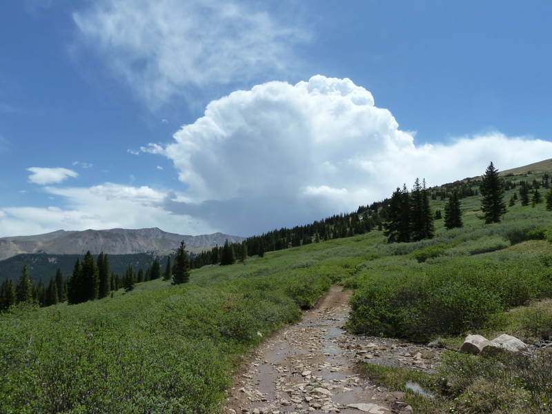
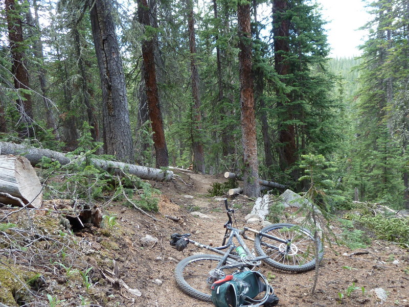
I skipped the singletrack that heads south from Marshall and took the jeep road that parallels it to save time. I had been hearing about lots of trees down on the singletrack, which would slow me down, and I guessed the road would be quicker either way. I was headed toward the storm--it was mostly south of Marshall and appeared to be moving east; we were on an intersection path. It wasn't raining, but it was noisy. I hurried. I really thought I might be able to drop into Silver Creek before it got bad.

But it didn't work. After I got just past where the singletrack Colorado Trail/Continental Divide Trail joins the jeep road I was on, the lightening started to flash directly overhead and the delay between flash and thunder told me it was within a mile. I stopped and sat on a log under a grouping of fir trees to wait it out.

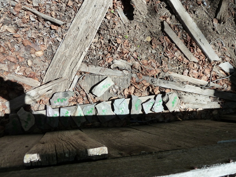
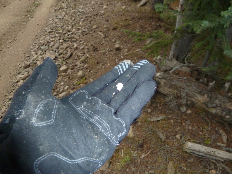
After I'd been there 10 or 15 minutes a little graupel fell, and I took the opportunity to photograph a piece of it. In the picture it just looks like a little white stone, but it's frozen water of about the same density as Styrofoam.
  antora peak

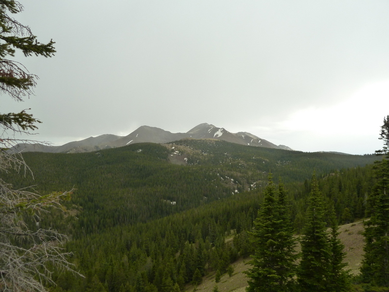
Once it seemed safe to continue, I got to the place I call the lunch spot. It overlooks the Silver Creek drainage, and has Antora Peak to the south as a backdrop. It looked like whatever rain the storm had was being dropped on Antora, and maybe a little graupel glaze as well.

I'm so lucky. I can get up on a Saturday morning, leave from my house on a bicycle, ride it through this country and then down 20 miles of singletrack back to the highway that gets me home in no time.

Magic.

Welcome back summer.