
Hidden Hidden Canyon
I checked out the map that is posted by the vault toilet on Gooseberry to figure out how to get to the Hidden Canyon Trail. I thought I had remembered where it was, but had not stumbled on it during my ride on Saturday. I made some mental notes, and gathered some landmarks to watch for then set off.
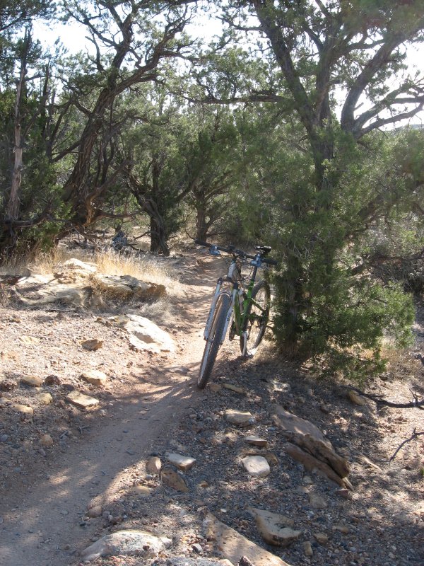
I passed trailheads for the South Rim Trail and the North Rim Trail and got to a point where I figured I’d see Hidden Canyon. My odometer estimate told me that it would be about a mile past the parking lot, which was about a mile past where the POD was set. Eventually I saw a cairn marking a singletrack off to the left. It was in the right place, but there was no carsonite sign, and I was sure that Hidden Canyon was a system trail. I tentatively rode past, then saw a marker for the beginning of the state trust land. Aha! The trail began just before the doubletrack entered state trust land! That un-signed singletrack was it. I doubled back and went in there.
It was just as I remembered. It had been the one trail that stuck in my memory, much more singletrack-ish than the rest of Gooseberry. It had some very challenging slickrock features, but then wound between boulders and piñon. Lumps of petrified wood were everywhere. Wonderful.
I wondered why the official trail marker was gone. Had BLM of the State of Utah decided to try to make it disappear? If so, that wasn’t working. Lots of folks were riding it.
I popped out onto the South Rim, thoroughly satisfied. I looked for the white paint spots to lead me east and back towards camp so I could now get on with my Little Creek adventure. I had also wondered how I missed the intersection with the South Rim Trail when I rode it Saturday. But clearly by the time I got to the rim I was already on the South Rim Trail. I would have to double back to find the way east, but I knew that I was on the verge of some really fun stuff out toward the western point, so I decided to just ride around the horn and then take the North Rim Trail and the Windmill Trail back toward camp. Those bits have such a nice view of Zion NP.
By the time I got back to the POD my odometer showed a little over 13 miles. I stopped in to get a few more Scooby Snacks since it looked like I was in for a little longer day than what I had originally intended.
Over to Little Creek Mesa
I quickly made my way back out toward highway 59, road back to the west of about half a mile on the highway then took the left turn onto a dirt road that looked like the most direct way onto Little Creek Mesa. From the map it showed that there were several ways, which made me a little nervous. The last time I went up there was with Jim and we drove. Or I should say Jim drove, so I didn’t need to know how to get there. That’s why I didn’t remember exactly how to get there.
I climbed up the dirt road after referring to my ballpoint map. I saw some things that I remembered, so I felt good about being on the right track. The day was warm and I was wearing a long-sleeved jersey because that was one of the few I had left that were still clean. I figured it wouldn’t do me any harm to keep the sun off my arms for one day anyhow, but it was a little warm.
Somehow I got turned around once I was up on the mesa. I don’t know how I wound up on the doubletrack I was on, but I came into a camp that had obviously been used by 4-wheeler people since their tracks were all over. In a big sandy clearing was a messy fire ring which a walmart bag full of garbage left unceremoniously in the middle. This was Monday morning, and it had obviously been left there over the weekend.
I have heard that the trails on Little Creek are not being supported by BLM, and that they are trying to keep them from become officially recognized. It amazes me that they would wring their hands over a few bicycle trails when these 4-wheeler scum are abusing the area. Not only is there trash scattered all over, but they have made a network of crude trails all through the sage and slickrock all around me. Assholes.
I make my way past the camp and try to proceed in the right general direction, but I’m starting to think I’m screwed. I hope to find my way back onto the main road without having to double back, but soon find myself following some of the new 4-wheeler trails, eventually dropping into a wash that is bottomless sand. I push my bike and consider using the GPS to give me a trail of breadcrumbs back out of this mess. Then through sheer luck I find my way back onto a graded gravel road. I start heading west and assume I’m on the right track. Soon I see the radio towers that are a landmark on my map. But I don’t want to go to the towers, I want to pass south of them I think. I newly graded road goes off in the right direction, but it is less wide than what I’m on, and looks like it may have just been created. I stay right on the wider road, and soon I’m right at the radio towers. Crap. I reach into my jersey pocket for my map. It’s gone! Damn. What did I do with it? I take off my pack and search it, re-check all my pockets. Gone. Crap.
I follow a minor doubletrack that goes off to the west of the Radio Towers, and immediately it starts heading down off the mesa. I decide I might as well double back. Perhaps this just isn’t my day to find the trails on Little Creek. I’ve already been riding for over 25 miles and it doesn’t even feel like I’m close. I ride perhaps another quarter mile, and there’s my map laying in the road. Woo hoo!
After consulting with the map I decide I need to take the newly graded road that goes off west. It looks like it could really be the way that I had intended to go, so I take it and ride on. I at least feel like I know how to get back out if it doesn’t work. After a mile and a half or so it intersects with a wider, more traveled road. Yes, this actually has a bit of familiarity. I stop to answer nature’s call then remount. My rear tire is flat. I know where it happened, I hit a pretty good chuckhole on one of the descents just past. I put my spare tube in, and take a minute to lube my chain. It’s now about 1 o’clock and I’ve ridden about 30 miles including my bit on Gooseberry.
I ride up this bit of rough road, which climbs steadily. I remember what the place looked like where we parked years ago, and I’m watching for it. My odometer starts marching up into the 30s. Oh well, it’s an adventure, whatever happens.
I come up over a rise and there I am. I’ve gotten to the parking area, which is unimproved. Just a patch of slickrock with a few places people have traditionally parked. Nobody is parked there however. Looks like I have the joint to myself.
With a little deliberation I find the singletrack that peels off to the right. When Jim and I were here, we got confused and missed this and wound up riding down a doubletrack for miles before doubling back and finding the way in. So I remember where to look, and I know that it’s not obvious. There! Ha! I ride in there and begin having the time I wanted to have.
Little Creek is really cool--much more singletrack-ish than Gooseberry. I ride singletrack for a while then pop out into a slickrock area. Cairns mark the way now. Every once in a while you see a faint, faded white spot, but for the most part the way is marked by cairns. People have been riding it though, there are plenty of fresh tire tracks from the weekend.
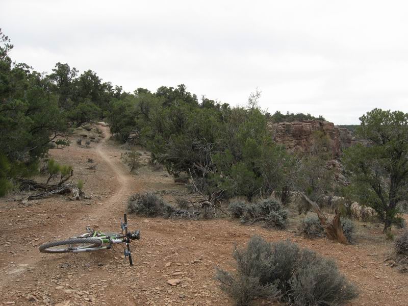
I wind up on a trail that is away from the rim at first, heading mostly west. It’s a wonderful time, faster and more flowing than Gooseberry. Then I pop out onto the rim facing north. There are parts of the trail that have real exposure to the cliff edge. Very cool. Now I remember, there’s a big loop that I seem to be taking clockwise. This part plays about with the rim, but sometimes ducks back in singletrack away from the edge.
Eventually I wind around to head more south, but still on or near the rim. I start feeling a little tired in the legs. My odometer shows nearly 40 miles.
I’d been warned about how route-finding is a little tougher on Little Creek than it was 3 years ago, but so far it’s been pretty easy. Then I come to a T-intersection on singletrack. The left way seems to be heading in the direction I want to go to get out, so I take it. I roll downhill and pop out onto slickrock, I see a cairn and head that way, pass it, then no more. Huh? Where? Way off, down a little side wash I see what appears to be a cairn. I drop down the most technical thing I’ve ridden yet today, a stair-stepping pour spout down into this side canyon. I ride a hundred yards and come to a boxed in place. Doesn’t look like there’s a way to continue and I see no cairns. I backtrack and push my bike back up through the pour spout. I stand on a high spot with a dumb look on my face scanning for cairns. I see the ones that I saw when I entered this little bowl, but nothing else conclusive. Eventually my addled brain adds it up, and I decide I need to go back to that T-intersection and go right rather than left.
Climbing back to it takes longer than I think it should. I’m wheezing a little and starting to feel thirsty. OK, better just wrap this up and start heading back. When I finally get to the T I start scanning the trail for my own tracks. Have I been this way? I switch my GPS to the map view, and I can see that I’m slowly closing a loop, so as long as I continue heading toward the track that I laid on the way in, I should be able to find my way out of here. Yep, the legs are getting tired. I’m definitely mortal. I’m down to one partial gel flask and my emergency clif bar. Plenty of water I think (I squeeze the bag, and it feels like there’s enough there to keep me going for a while). I get confused one more time, back when the GPS tells me I’m on my route in. It doesn’t look familiar. But I was kind of hauling ass back then…
Finally I find my way back to the parking area. I roll back out on the graded road, and this time I take the way that looks more right according to my map. Yep, this was the direct way. I should have gone left at the strip mine rather than right. Or did I go right? I don’t know, I don’t care. Just want to get back to the POD to put food into my face.
The return trip was pretty uneventful really. It only took me about an hour and twenty minutes to go all the way from the Little Creek Parking area to highway 59 (all downhill) and then on up to the POD. Still a long day, but a danged fine one!
1 comment:
Couldnt agree more with that, very attractive article
Post a Comment