Friday, June 27, 2008

Alpine Trail

Today John shuttled me up to ride the Alpine Trail, the last part of the 2008 Cream Puff course. Having seen this section in addition to the trails I rode yesterday, I have now ridden all but 3 miles of the singletrack on the course.


Alpine is really beautiful. Big surprise, eh?

Counting down to Sunday morning. Early. 5:15 AM Pacific Time.

Thursday, June 26, 2008

A Three-hour tour

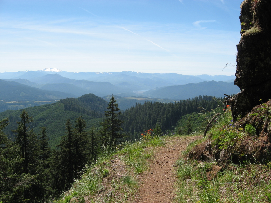
I have arrived in Westfir and am enjoying the warm hospitality offered by my good friends Phil and June. Damn is it pretty here. 
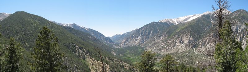
Lots of green stuff.

My first morning in Westfir I meet a fellow racer, John, who has just heard that there is a section of this year's course that should probably be seen in order to understand what is coming. The Winberry Divide Trail preceded by the Tire Mountain Trail has been described as "tough". So John and I decide to drive up there to ride it, either out-and-back or using the fire road climb (forest road 1802) to return to our vehicle parked at Windy Pass.


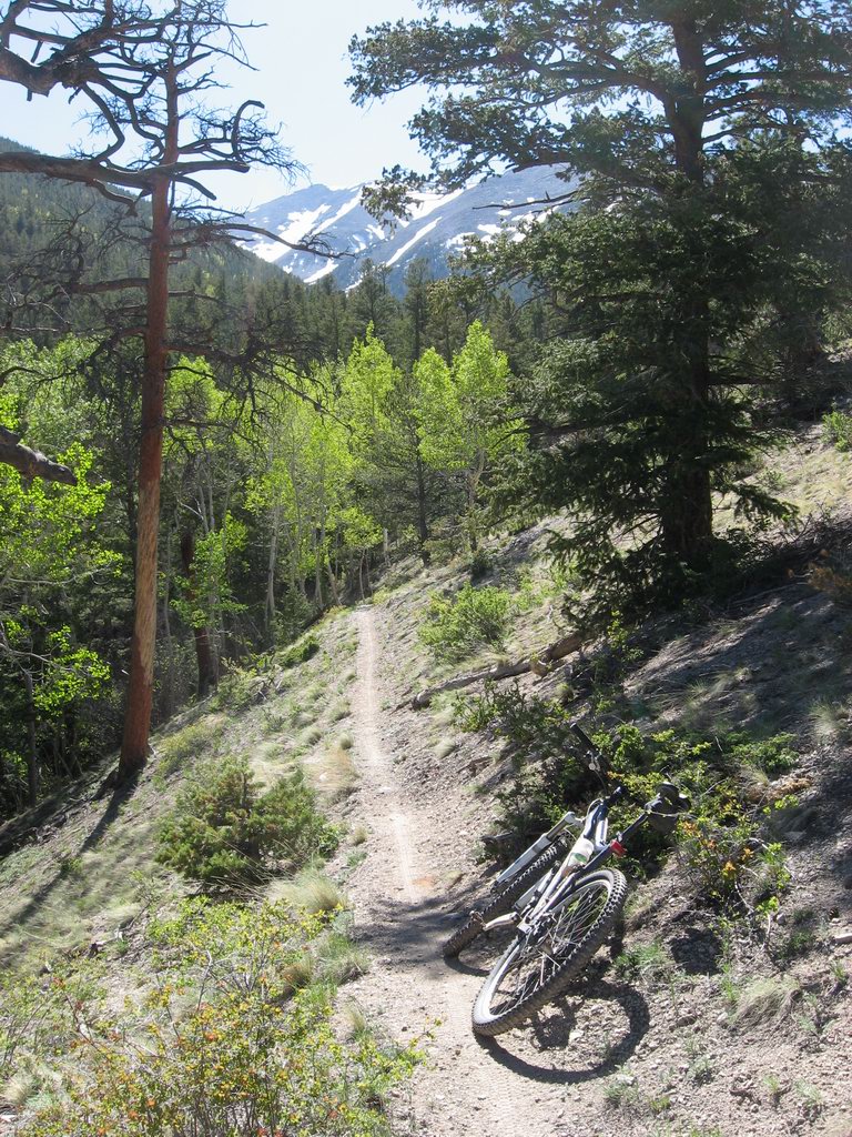
The first singletrack is the lovely and amazing Alpine Trail. To follow the course we leave Alpine after about 1.5 miles in favor of Tire Mountain.
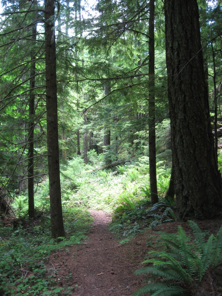

Wow.


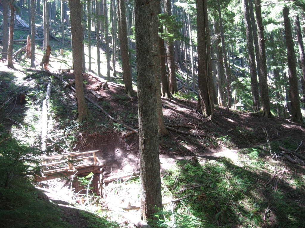
More wow in this section of Tire Mountain.

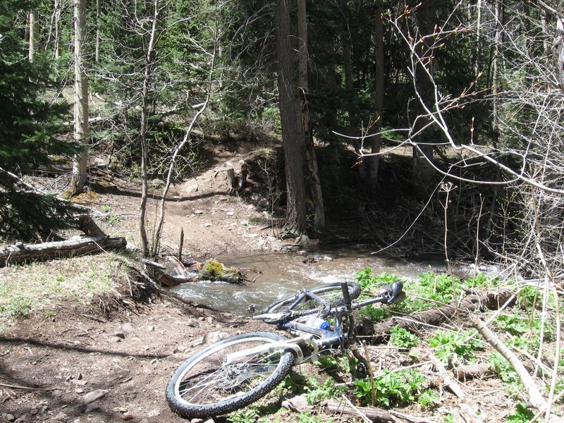
Tire Mountain is full of tight, tight switchbacks. It's so fun and challenging, so beautiful. Then I notice that we are really only descending at about 9 mph. Hmm. Just making that rate on the descents? Uh oh.

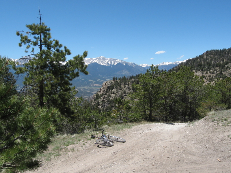
Then comes Winberry Divide. Lots of steep climbing. Beautiful, yes, but strenuous. More slow going.

My emotions are mixed. Oh the pretty singletrack; but 12.5 miles of Alpine Trail, Tire Mountain, and Winberry Divide cost over 2 hours. Sure, these pictures got snapped and there was some yakking, but it took time, baby. And effort.

When we reached the end of Winberry where the fireroad climb was to commence, something went awry. Perhaps we paid too little attention to the course markings, or perhaps they had been sabotaged (there was some rumor of that on http://www.cascadecreampuff.com/2008_status.htm). We wound up back at a place where the singletrack had crossed a fireroad. We had gone in a circle. There was head scratching and map consulting. Both of us were a bit more tired than we had planned to be 3 days before the race, so we decided that the best plan would be to bail down to the North Shore road and roll back to the RV park, then take my truck back up to get John's rig. Question was, which way was the North Shore road?

Long story short, we took one bad turn then one more. We wound up descending to two different dead ends. Then we decided that the only good option was to backtrack up the singletrack. Which was unfortunate, since it had descended like a lead balloon just before we got turned around.

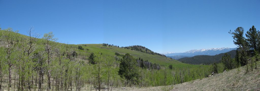
After the grind back up to a high knob, we dropped onto another fire road. I was skeptical, John was confident that we had found road 5823. After much map reading and harrumphing, I agreed that we should give a descent down this unmarked road a mile then pass judgement.

Turned out to be a good deal. We got down, then rolled back to camp on the nice, flat North Shore road. It was a 35 mile day and well over four hours. More than I wanted to ride, but much was learned. And I got pictures. And there was plentiful dinner. By far better than working!

Wednesday, June 25, 2008

Oregon or Bust

Time to roll out to the Cascades in Oregon to get down to the business of finishing the Cream Puff.


One of central Oregon's lonesome highways, with the snow-capped Cascades on the horizon

The drive out here was long but scenic. I stopped off in Boise to see my old bro-in-law and his girls. That was really nice.

Paying for gas, not so much. I keep thinking I hear my wallet screaming. Or perhaps its the sound of evil, maniacal laughter from the oil industry.

Tuesday, June 10, 2008

Colorado Trail Day

Monday ride day. This time I was looking for a tough ride to make me feel the hurt. I chose to climb to Blank's Cabin almost due west of Salida, jump onto the Colorado Trail and ride the uncivilized bit up to Chalk Creek, then climb up out of Chalk Creek to the section north from Mt Princeton Hot Springs. Then ride home on the road.

Started out spending two hours climbing into a stiff headwind. Man have we had wind this Spring! Then I made it to the CT for the grim hike-a-bike up to the high point of the whole day at around 10,200 ft. From there I embarked on the burly up and down toward Raspberry Gulch.


The Colorado Trail just north of the Mt Shavano trailhead

Pretty day, and I found shelter from the wind along the front of the Sawatch Range.


Chalk Creek Canyon as seen from Colorado Trail overlook just south of descent into canyon

Time to drop down to 8,220 to the Chalk Creek bottom, then down the road a few miles to Mt Princeton Hot Springs. Then up and up to the Mt Princeton Colorado Trailhead at around 9,500 ft.


The Mt Princeton section of the Colorado Trail

I intended to ride up the Colorado Trail until I hit the 10,000 ft mark, but I just didn't have the stones to do it. I was getting tired of being on the bike, running low on water, and ready to be home eating dinner then sitting on my butt.

I wound up with a 59-mile day and nearly 6,600 feet of climbing. I got home feeling tired enough and at least had some pretty pictures.

Saturday, June 7, 2008

Aspen Ridge

For my Saturday training ride, I chose Aspen Ridge today. Northeast of Salida in the dry Arkansas Hills, the road over Aspen Ridge crests at about 10,350 ft elev. I wanted to confirm that it was snow-free. It was. Quite dry actually.


View towards Mt Antero showing some of the rock formations in the Browns Canyon proposed Wilderness Area in the middle ground.

There's some steep granny gear climbing to get to the ridge, and it was hot and windy today. Here's what the north edge of the Sangre de Cristo range looks like from Aspen Ridge:

Wednesday, June 4, 2008

First '08 Rainbow

Monday I stole a chance to get a Rainbow fix for the first time this year. Chaffee County singletrack is opening up. We're up to 10,000 feet now. The Crest? Gonna be a while. But our local bits of Rainbow and Colorado Trail are open, even if there's a snowdrift or two weeping onto the trail.


Creeks are running big. Really good for getting all that pesky chain lube cleaned out.

Nice.

And speaking of nice, check out this article about one of the coolest Denverites out there:

http://www.denverpost.com/headlines/ci_9458980

Sunday, June 1, 2008

Independence Pass

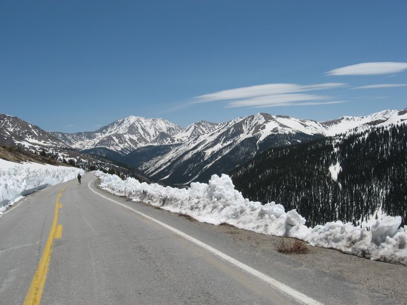
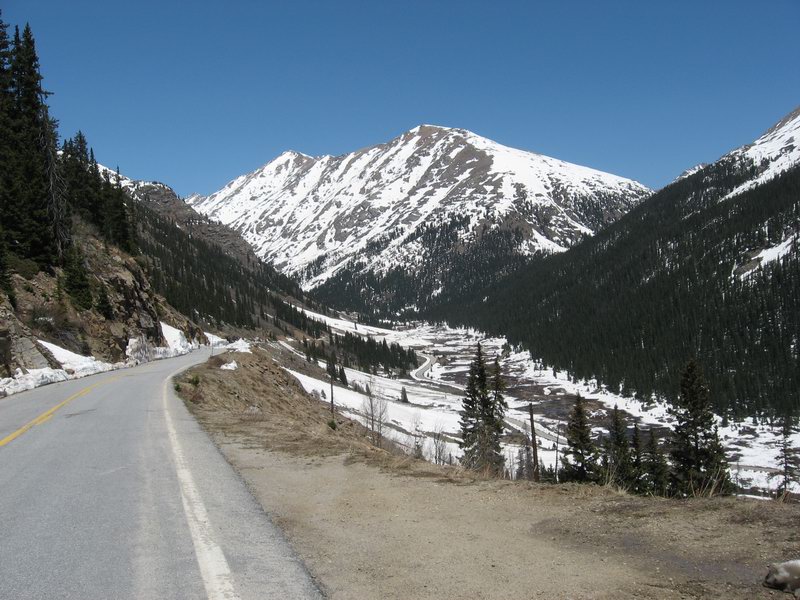
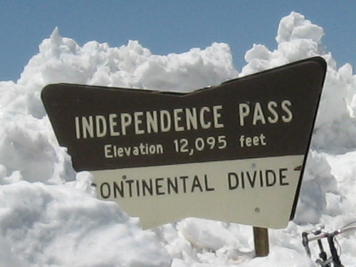
Every year as Memorial Day approaches, the Colorado Department of Transportation (CDOT) endeavors to clear Independence Pass for motor vehicle traffic so that tourists can drive their RVs and rented Ford Contours from the Arkansas Valley over the Continental Divide into Colorado's enchanted ski town, Aspen.

Some lucky cyclists know that there is almost always a period of time after the snow has been cleared from the road but before the gate is opened. During that time the way up to the top is free for cyclists to enjoy without worrying about being run over or even having to listen to the cars roaring by.

This year the intrepid CDOT snow-movers were not able to get the pass open for Memorial Day. Nor was much of the tarmac free for cyclists to enjoy. But this past week word got down to Salida that the road was clear at least from the east approach up to the pass, and that the closure to motors would lift on the weekend of June 6.


My girlfriend Kathy and I drove up to Twin Lakes Saturday morning, unloaded at around 10:30, and headed up to climb to the pass. There was a bit of a gusty breeze just at first but amazingly it more or less petered out as we got up higher. When we left Twin Lakes it was feeling pretty warm, but gradually it got a bit chillier. But it never got terribly chilly, just pleasant. The sights and sounds were storybook Rocky Mountain springtime; brilliant white melting snow, trickling and running water, birds, breeze in the pines--and of course me wheezing.

It's hard to imagine a nicer ride on pavement. As we made our way up higher, the sweeping panoramic views became more and more dramatic. At the very top, the breeze forced us to quickly put on wind breakers. We snapped some photos, then started heading down.


The first half of the trip down was chilly. Hard to transition from working the climb to zipping down without any effort at all. But once we had dropped 1500 feet or so the air temperature came up and the road became flatter. At times we even had to pedal.

We got back to Twin Lakes at around 2:30. We loaded Kathy's bike into the truck, then Kathy drove back to Salida. I needed a long ride, so I took off on my bike to ride back to Salida.

The ride home was much less Disney than the out and back to the pass. It was much flatter, much noisier, and notably warmer. Luckily there was not too much wind, so I was able to make pretty good time. But I got home tired at around 5 PM.

Pretty damned good day all around.