Saturday, April 28, 2012

April Aspen Leaves

I asked around this week about the Rainbow between Bear Creek and Methodist Mountain.

This bit of Rainbow Trail is south of Salida--the slope of Methodist is a big part of our town's setting. It is our southern horizon.The trail was introduced to me the first time I came to Salida specifically to be in Salida. I came for the Banana Belt Mountain Bike Race in 1997 or '98, can't remember exactly. That classic race course took us up the Bear Creek Road and then traversed Methodist Mountain on the Rainbow.

Well, anyway, this bit of the Rainbow is right up there near town, and it's the first high singletrack in the area to melt out and open in the Spring. What I heard was that it was dry, but that the big winds we've had this year had dropped lots of trees. I also heard that the moto community had been up clearing trees. But I knew I was taking a chance. Maybe it was a tangle of blowdowns, maybe it was open and good to go.

early leaves at 9,000 feet

I found a trail that was dry. Lots and lots of down trees, but through which the chainsaws had made a path. Most surprising for April 28, aspen almost fully leafed out. Leaves, at 9,000 feet in the Rockies, April 28. New aspen leaves are supposed to appear in late May. Maybe the 20th. But May, not April.

leaves unfurl

Here's a close-up of a young aspen, with leaf buds that are popping open. The fully mature leaves will be out by mid-week.

It's dry people. The snow is almost gone. The Arkansas has already gotten a little bit discolored. That should be 3 weeks away.

Reminds me of one of the first years I lived here. In 2002-03 we had a drought. Nothing turned green that summer. Irrigation water was scarce at first, then it dried up completely. The Hayman Fire burned up Tarryall and the Lost Creek Wilderness. In New Mexico, the Carson and Santa Fe national forests were closed.

Maybe that's what we have in store for 2012. Dry, wildfires, restrictions and closures.

Rainbow at Bear

But for now, I'm going to enjoy my mountains. Today was nice. Of course it's a treat to enjoy late May riding in late April.

Monday, April 23, 2012

Doing it the Hard Way™

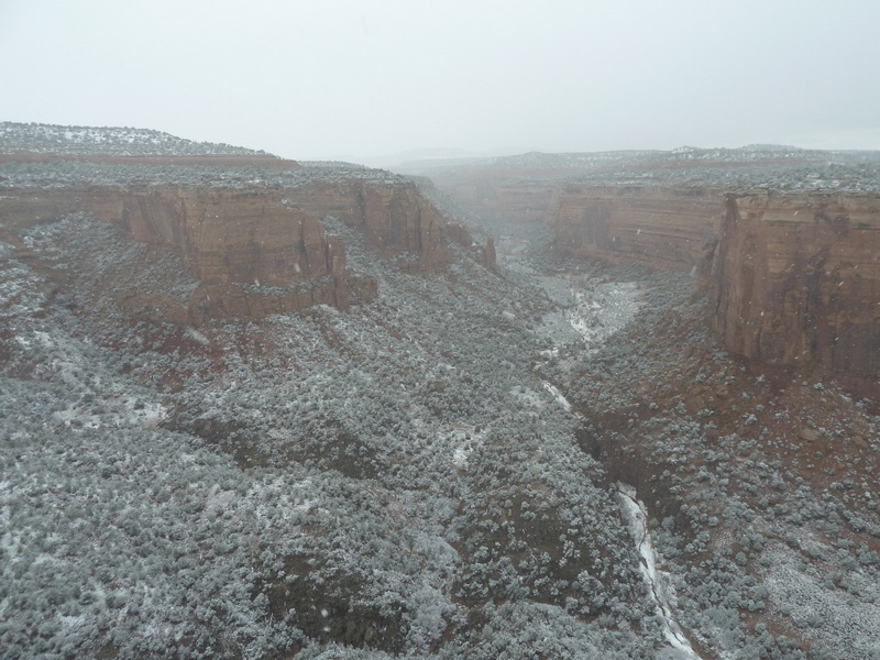
Late this past week I was thinking about a scouting problem that I had uncovered when looking at my topo maps with the two SBFL routes drawn on them.

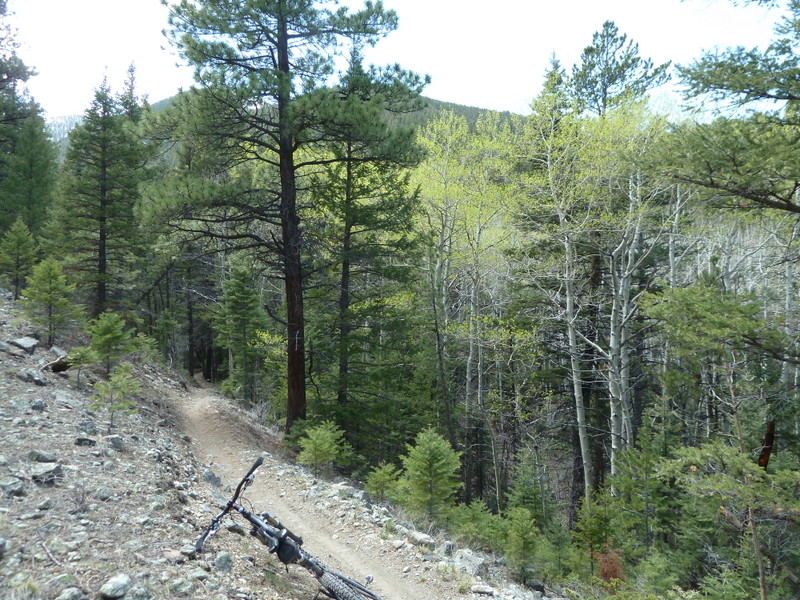
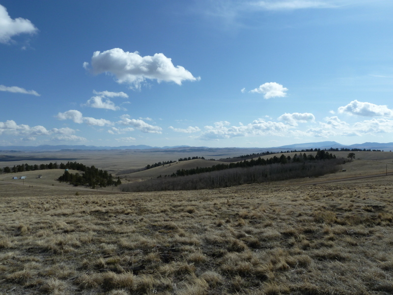
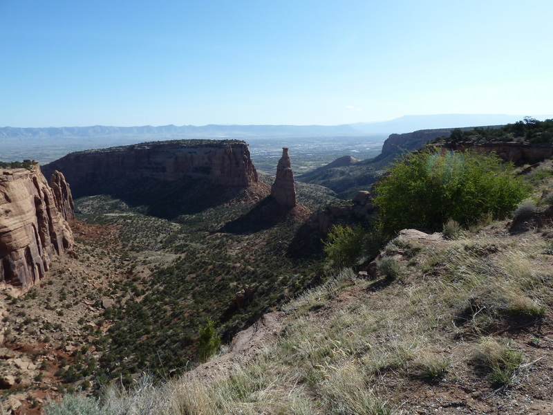
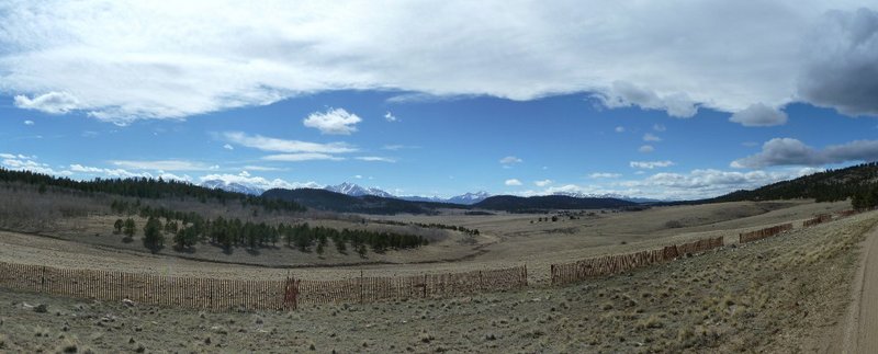
From a place shown on the topo maps as Black Dumps, an intersection of dirt roads overlooking Bassam Park, my route lines went down off the ridge following a line that was not on any route showing on the map. That doesn't mean there isn't a route there, only that it needs to be confirmed that there is one.

The route line came from the original Harvest Moon Ride. Back in 2005 we went that way. But from last week's scouting trip, I could not remember 5 ways out of Black Dumps. I could remember 4. I felt the need to put my eyeballs and tires onto the segment of the route that I had included in both Standard and Long Loop courses.

Panorama of Bassam Park

So I needed to get up there one more time.

I had a little extra time this week since I had worked some overages. And I made my first bike commute on Tuesday, so I felt like I could do that again but then take the afternoon off and go home the long way.

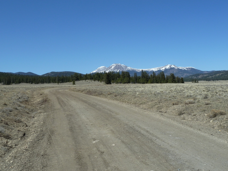
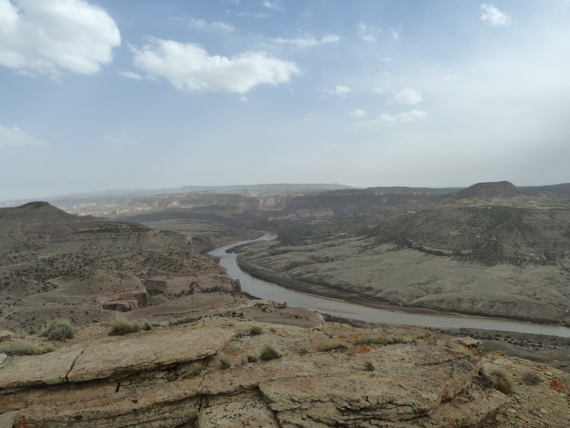
I also wanted a nice clean GPX of the route from the end of the Midland Trail, up Shields Gulch and the Lenhardy Cut-off to McGee Gulch and back to Highway 24/285.
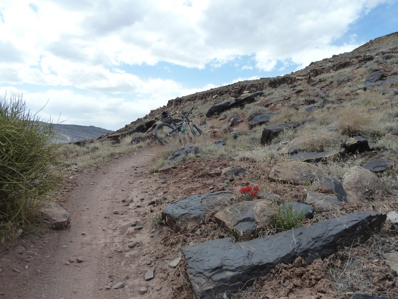
So I rode my Hunter Cycles dirt tourer to work with everything I'd need for a big backcountry ride. It started out as a normal road ride to BV, but then I hit an evil head wind about half way and had to grind my way the last hour into that mofo just to get to work. Ouch.

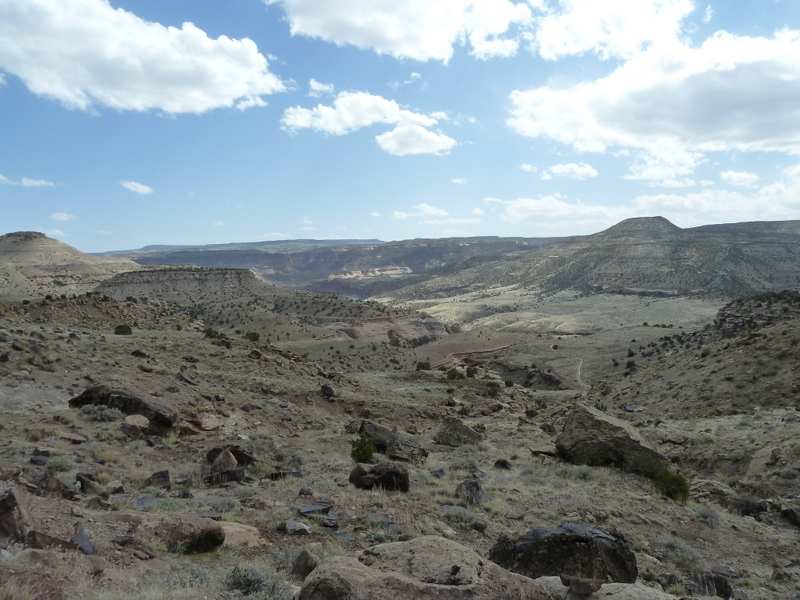
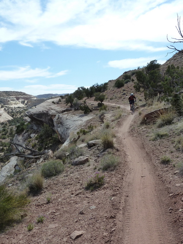
I worked through the morning then left BV at 1 PM and headed up the Midland. By about 2:45 I was across 24/285 and heading east toward Bassam Park. In my scramble to leave the house I had neglected to load a GPX of the short route that I could follow. I needed to get to Black Dumps, and I wound up going from memory. But memory can be fallible.

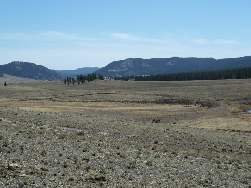
I encountered a left turn off the main road into Bassam Park at about 3:30. It was marked Castle Rock Gulch 2 miles, Dry Lakes Gulch 4 miles. I remembered Dry Lakes Gulch, I had come up that way the week before during my long route scouting trip. And I thought I already was on the Castle Rock Gulch Road (turns out I was, Castle Rock Gulch is pretty long. Odd that they were saying it was 2 miles because I had been riding in it already for at least 2 according the the topo.)

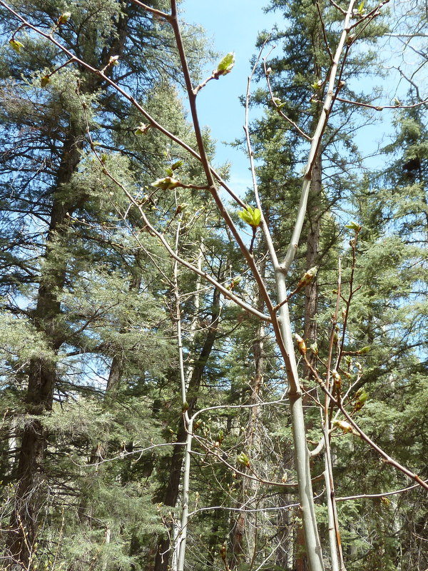
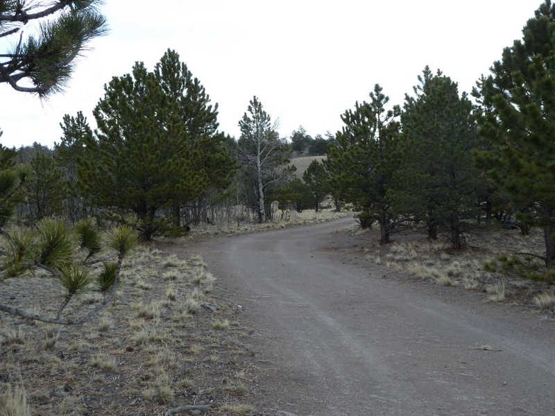
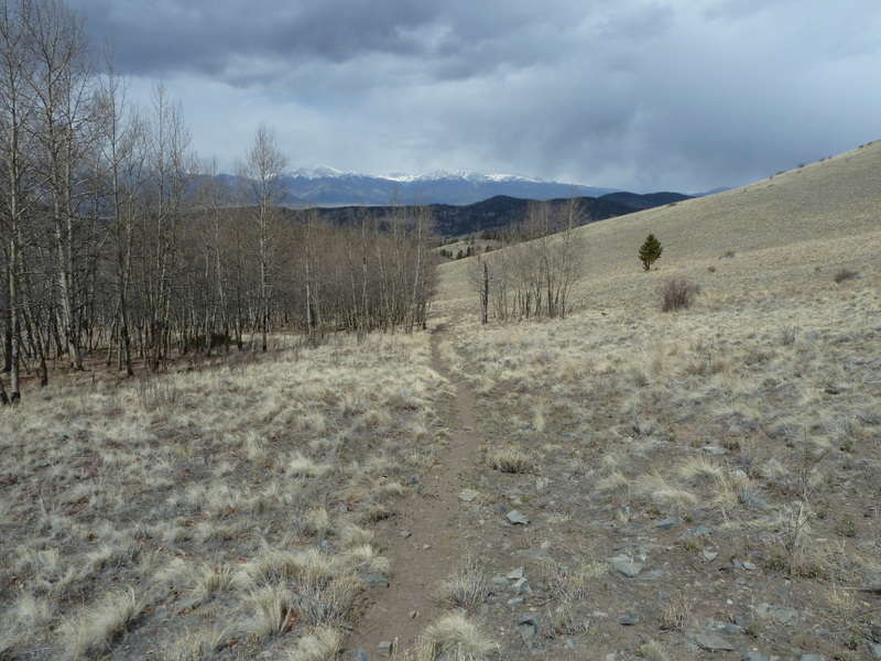
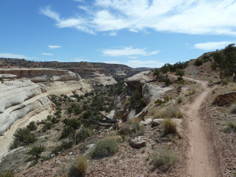
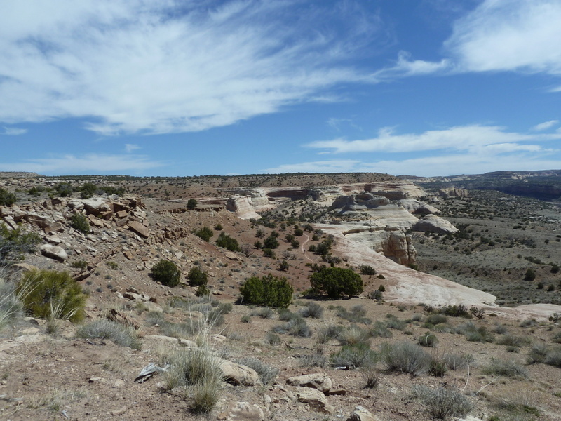
Well, that road was wrong, and it's not practical to make it part of either of the loops, but it was beautiful. The whole time I was on it I was worried that it was going to take me out into the middle of nowhere (which that whole area would be considered by some standards). So I was kind of nervous and hurrying, and therefore took no pictures. Too bad, it was nice. I will go back sometime though.

Elk in Ark Hills

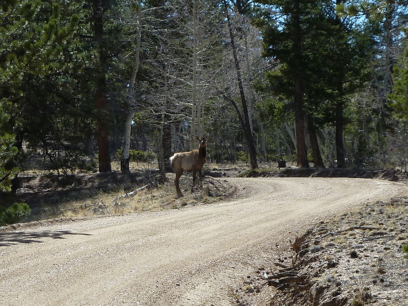
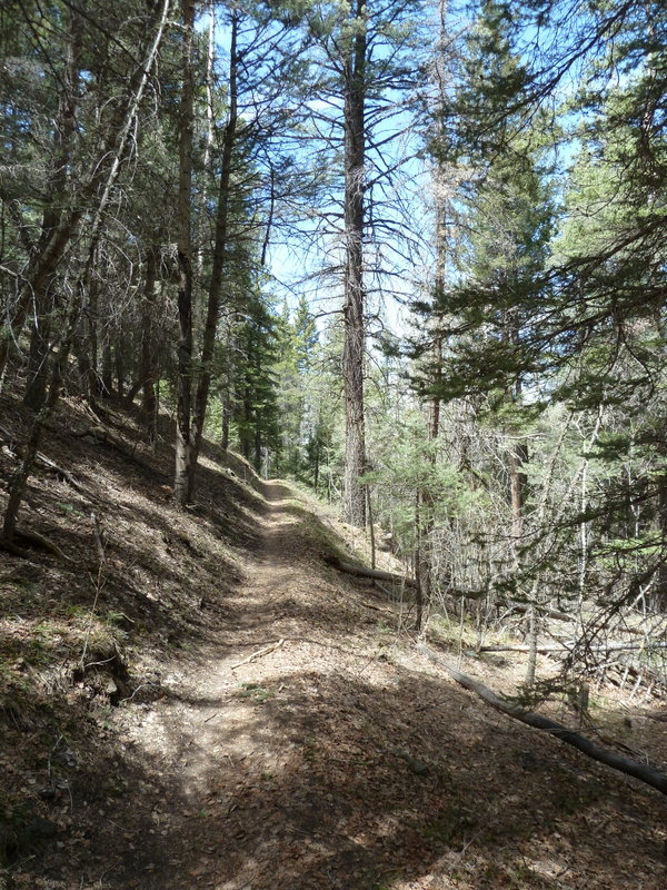
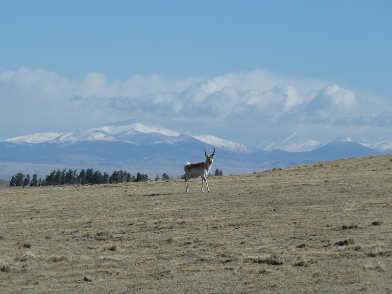
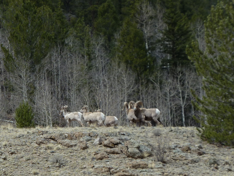
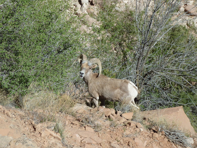
Eventually I did find myself back on the road that is part of the long loop. Shortly after I saw that I was in good shape route-wise, 4 or five elk ran across the road in front of me. This one needed to check me out for a while. He (or she, too early for antlers) stood and let me take pictures for almost a minute.

Ouray as Seen from Bassam 
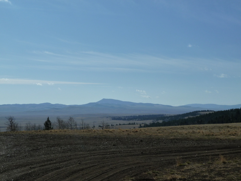
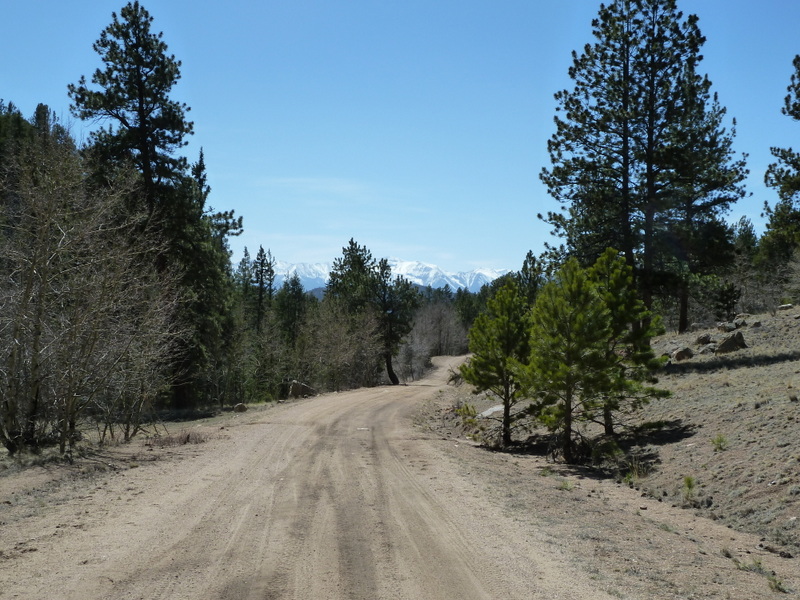
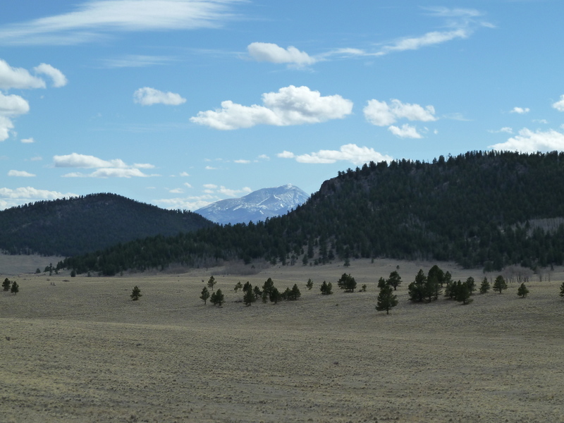
Chaffee County Landmark, Ouray Peak doing a peek-a-boo between hills along the west side of Bassam Park

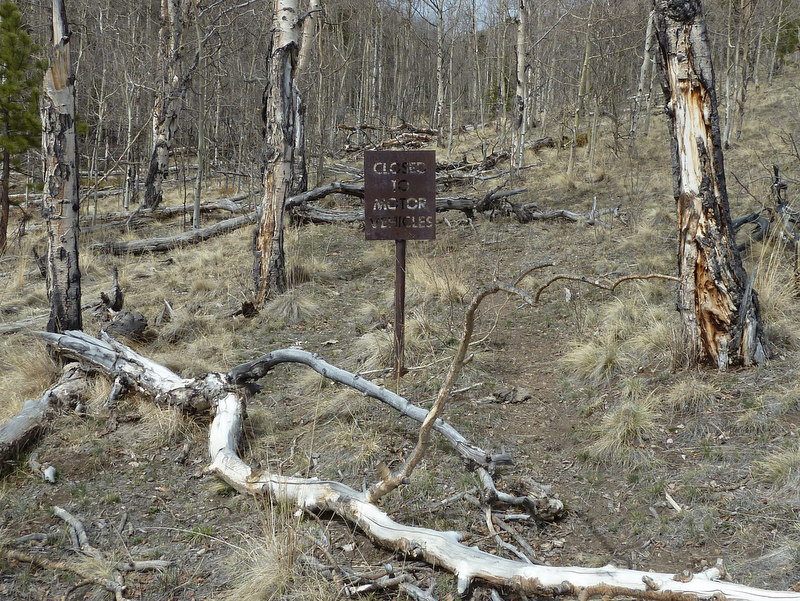
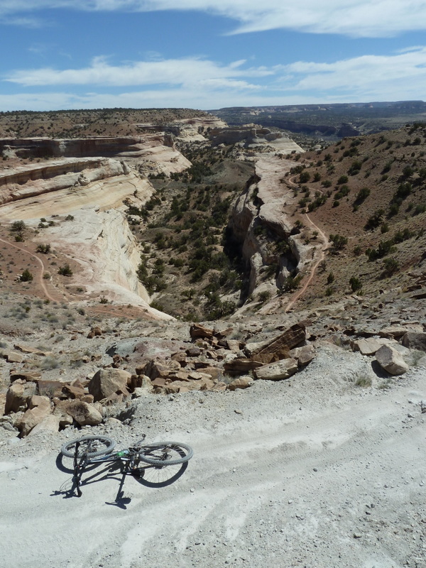
Well, when I got to Black Dumps I found that it was a good thing I was doing this. There was no road going in the direction that the track from the original Harvest Moon Ride took back in '05. After looking hard for some way off that ridge directly down to the road to Aspen Ridge I saw a bootleg ATV trail that the forest service had closed. Ah, we must have followed that ATV trail back when it was still there.

No way am I going to route the SBFL down a closed trail. The routes are both going to need to be altered. Good to know now!

Sawatch from Aspen Ridge

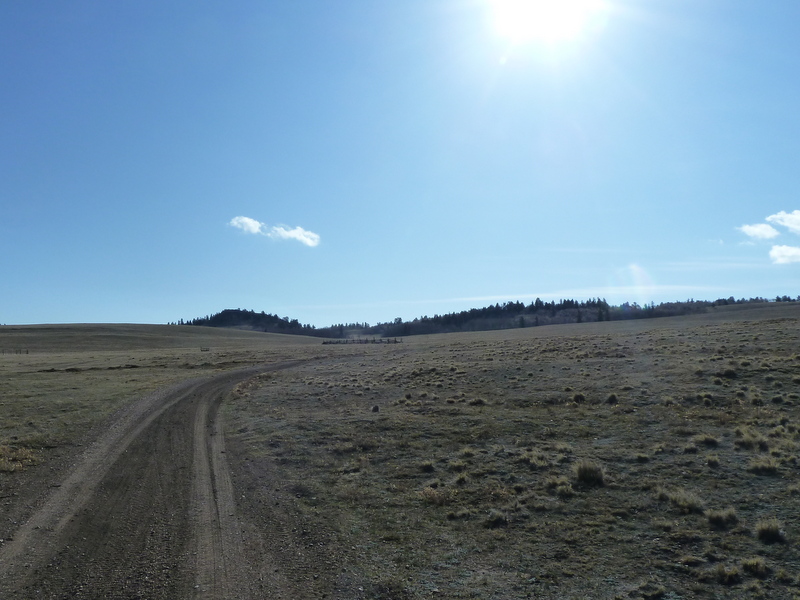
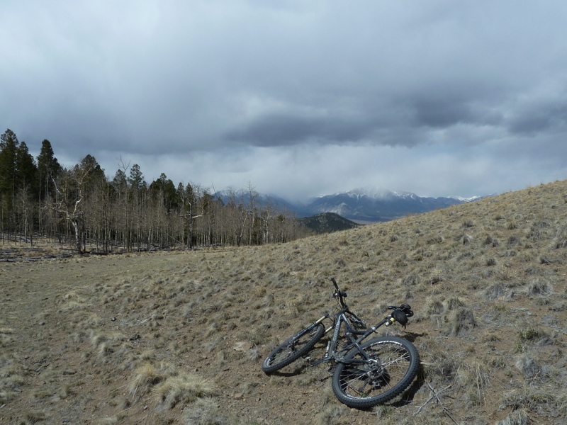
So my route confirmation task was complete. Now about riding the rest of the way home... Time to climb up and over 10,300 foot Aspen Ridge.

I was Pretty. Darned. Tired.

With the 25 miles I had ridden, much of it into a gnarly headwind and the 30+ miles I had already ridden from BV, I was well into a riding day that would turn out to be as big as any ride I have done probably since July of last year when I developed a knee problem that kept me from riding pain-free for more than 3 hours.

I actually had not ridden over Aspen Ridge from the west side for a couple years. Funny  how your memories wind up being a little different from the reality. I think that what happens is part of a self-defense mechanism: when you're put through a harrowing ordeal like a car accident or The Cascade Cream Puff, you don't store very complete memories. Your brain helps you cope by forgetting the details of the painful situation.

I made it home about 6:30 PM after a hard core descent off Aspen Ridge. Bikes without suspension make you pay big time for hurrying off that divide. Ouch.

The GPS told me that the part of my trip that involved getting home from BV was just shy of 50 miles. A little over 5,000 feet of climbing. Add to that the 25 miles spent getting to BV on the road, which has a little over 1,000 feet of climbing (and featured a painful headwind in this case) and you have a pretty hard day. I'd call it about 60% of a Leadville 100, but without any aid stations or cheering crowds.

For early season, this was a hard ride. But it feels good that I could do it--nice to have that knee issue behind me. And I did get some good scouting done.

As a postscript, on Saturday while hiking with Kathy and her mom I ran into my friend Taf, who's a former Ft Lewis College mountain bike team racer, Arkansas Valley ranch girl (I think she's a 4th generation Chaffee County resident) and who is signed up for the SBFL. She and her friend Mark had just ridden across Bassam Park and down through Futurity. They told me that there is a way to pass through Futurity without hike-a-bike. Then Mark sent me a GPX.

So I have some choices to make in terms of finalizing courses. As of now, the long course goes through Futurity using what had been an option with hike-a-bike, and the short course now doesn't even have the option of going through Futurity. I could allow the short course to go through Futurity, with or without the hike-a-bike. And I could allow the long course to take the non-hike-a-bike route that Taf promises me is there (and I have a GPX that shows it thanks to Mark.)

But I'm more inclined to make the long course riders see Futurity the Hard Way™.

When I've had a chance to rest a little more I'll make the final, final course GPXs. There are two new ones out on the SBFL site now, and they may wind up being final. I promise to have the finals posted by April 30.

Sunday, April 15, 2012

Scouting SUCCESS!

The National Weather Service was predicting a very gloomy weekend, and I was bumming because I wanted to finish up my scouting. Much of my free time last week, mostly in the mornings before work, had been spent messing around with my GPS trying to get it to work the way I need to have it work to be a route-finding tool. Finally advice from the GPS route-finding expert, Scott Morris got me to a solution. I loaded my hand drawn route from Trout Creek to the ghost town of Futurity, connecting to the SBFL course. And I started looking for my window of opportunity.
   

Saturday morning dawned mostly clear. Get while the gettin's good I say. I loaded up my bike and gear, drove to 9,500 ft Trout Creek Pass with warm clothes and food. And off I went.

I love a morning in a remote place in Colorado. Even when it's 30° F. This was a really good one, because it had the thrill of exploration and discovery all loaded up and ready to travel.
   
Waugh Mountain, a landmark I track during many of my Arkansas Hills/South Park type adventures

This part of the SBFL is going to feature lots of views of wide open South Park country.
   

This guy circled around me for 10 minutes or so while I peeled off clothes and ate a little food. He was more curious than cautious, but finally headed for the horizon when I re-mounted my bike and started moving.


Beautiful morning. Breezy, chilly, and the threat of weather. But as of 8:30 AM it was really pretty nice out.


As I followed the line on my GPS, a couple different times the route took turns that I wouldn't have picked without some clues that I'd gathered studying a map on a computer while drinking coffee. The third one passed through an opening in a fence with a sign that said No Outlet. It was a 90° right turn onto a much more faint doubletrack than what I was on. I stopped for a minute. What if it took me on a multi-mile wild goose chase that ended at a campsite up in the trees or a locked gate that has a Private Property, No Trespassing sign?

Well, it was still early. I was following something that looked right on the map, and I figured I might as well do what I'd come to do: Scout that route.


The double track went from faint to almost completely gone. At one point it looked like it might be heading right for a house, maybe a ranch house. But then it climbed up further on the slope and it became clear that the house was just a regular house in the Ranch of the Rockies subdivision. It went along next to fences a couple times, then popped out onto a graded gravel subdivision road that was so rarely used that it had grass growing on it. My little line followed those subdivision roads for less than a mile, then across a cattleguard and back onto a regular BLM double track. Woo Hoo! The route is solid, and it's relatively primitive! And the views are stunning. Win!


Just as the little line predicted, it turned west and headed back up into the Arkansas Hills, following a numbered Forest Service Road to where it would meet with the old Harvest Moon Ride route. Once I was there, at a place labeled on the maps as Black Dumps, I was golden. I had my SBFL Long Route.

Only one bit of route that I had not seen before remained, the bit from Black Dumps through the ghost town of Futurity into Bassam Park. But that was just a bonus. If it was good, good. If not I could still use what I'd just ridden to build the SBFL Long Loop.


I passed through the Black Dumps, a 5-way intersection of Forest Service Roads and followed my little line to the south. It did some climbing, a fair amount actually, then topped out at a little divide and started back down. I was watching my little line and the road ahead because I appeared to be approaching one of those infamous 90° right turns.

I passed a very much closed trail that the Forest Service had clearly put some effort into obliterating. There was a steel Closed To Motor Vehicles sign, a bulldozed hole at the start, and many many down dead aspen. Couldn't be it, so I kept rolling. But the GPS told me, nope, turn around. That's it.

Just like earlier, I had a decision to make. But now it wasn't earlier. I'd been out there for nearly 3 hours, I was many miles from the car, and random snowflakes were swirling around.

Crap.

I was about to head back to Black Dumps, then said to myself, "I don't have a motor vehicle." The topo on the GPS showed a fairly short climb to a saddle maybe 250 of elevation higher than where I stood. I could kind of see it through the tangle of leafless aspen. "Might as well see what's up there." Off I went, pushing the bike over deadfall.


You guessed it. About 15 minutes later I crested the summit. The sky was looking a little gnarly, but I could see most of the mountains across the valley. Couldn't be that bad yet if I could mostly see the tops of 14ers. Let's see how tangled the descent would be.


I rode down off the saddle, and almost immediately onto... singletrack! How long might it have been since mountain bike tires rolled on this bit of trail? Had they ever? Deer tracks, elk and deer poop, almost no barriers to rolling along at a nice clip.


In less than five minutes I was in Futurity. Success! Success #2!


I rolled down a good road out of Futurity onto the main Forest Service road through Bassam Park. Took the right turn and started making my way back to Trout Creek Pass to the car.  Came up on this little flock of Bighorn Sheep in Castle Rock Gulch. Then crossed 24/285 into Chubb Park and climbed up and around to finish a 38-mile 5 hour voyage of discovery.

Sweet!

SBFL is going to be killer. I've got the plan. There will be a standard 90 mile route, a long 102 mile route using the stuff I found today, but just getting onto the normal route at Black Dumps. From Black Dumps there will be the option to do the extra climbing and hike-a-bike needed to roll through Futurity. I'm going to plant some small rocks there with paint markings that will be picked up by riders as proof that they did that option. Fun!


Wednesday, April 11, 2012

Spring is happening


Mae B into Salida

Cottonwood Gulch, and just a single picture. Nice shot of little old Salida from Mae B. trail. Starting to green up!

Monday, April 9, 2012

Scouting Interruptus

In a couple months I'm hosting a little bike ride called the Salida Big Friggin' Loop, part of the Colorado Endurance Series. My man Matt approached me about putting it on last winter after having seen my Harvest Moon Ride write-up.

Chubb Park Buffalo Peaks
Riding up into Chubb Park toward the Buffalo Peaks.

We posted the GPX file from that Harvest Moon Ride, which happened WAY back in 2005, when we advertised the SBFL. But there were things about that route that were not ideal, so I've been meaning to buff it up a little and make it better. That means riding stuff and checking it out.

So I drew some lines on topos using TopoFusion, the state of the art in GPS software for mountain bike endorphin junkies. And I loaded some of those lines into my GPS and headed to Buena Vista to ride from town. From there I would ride up the very familiar Midland Trail, which is what I did with those Feier brothers all those years ago. But my plan this time was to ride up Shields Gulch to the Lenhardy Cutoff rather than jumping onto highway 24/285 like we did back in '05. I wanted to ride to Trout Creek Pass, and from there look for another route east toward Bassam Park and Aspen Ridge.

Denver and South Park turn in Chubb Park
Here's where the Denver and South Park narrow guage line took a big turn out in the park to head back toward Trout Creek Pass, where it would cross out of the Arkansas River Basin into the South Platte Basin (aka South Park)

Of course the Midland Trail is based on a railroad grade, a 19th century one. There's so much I could say about how important the Denver and South Park Railroad was to the history of the Upper Arkansas, and then get into the rivalry between the Denver and Rio Grande and the D & SP... Some would be fascinated, others bored to tears. Suffice to say, the railroad ran their tracks from South Park over Trout Creek and into the Arkansas Valley, and then over into the Gunnison Valley after building the Alpine Tunnel. Interesting stuff, for those of us who are interested in such things.

 But let's get back to my scouting trip. I rolled up Shields Gulch, turned right onto the Lenhardy Cutoff, and climbed to the pass over Limestone Ridge into Chubb Park. Then I pedaled up the nice gentle road in Chubb Park that heads up toward the Buffalo Peaks before turning back to the east to Trout Creek Pass.

My GPS had a track loaded that I had drawn which would (hopefully) take me southeast from Trout Creek, skirting the south edge of South Park and eventually turning west back up into the Arkansas Hills to meet with the original route.

Well, I got to Trout Creek and I was a couple hours into my trip; not fresh, but not crippled either. But the track I had drawn was not showing on my GPS' map screen. Confound it! I messed with the GPS quite a bit, standing by the side of a dirt road changing settings and pushing buttons (Geek!). Nothing helped.

So I started off in the direction I had remembered mapping, but soon came to an intersection that could have been right, could have been wrong. The obvious choice was how to get back to town: down. I decided I better just settle for a good bit of route recorded on the GPS and ready to go and a day well spent, and resolved to figure out why tracks were not showing up on my GPS map.
  Mushroom Gulch

I was at the head of Mushroom Gulch, which I rode down and enjoyed quite a bit. Very pretty views west to the Sawatch.


These beautiful rock formations with a lovely green sheen of lichen are called The Castles.

Nice ride. Back down to BV and home.


Tuesday, April 3, 2012

Fruita Trip, Coda

Monday morning was chilly and moist. There were raindrops on the cars in the parking lot and substantial snow visible on the grand mesa to the east and book cliffs up north. 


The plan was to drive up over the Monument and maybe take a walk on one of the half hour tourist trails that go to a nice overlooks. The higher we got, the more snow. And it was gorgeous. 


Spring Storm in Monument


I got lots of pictures, but we missed our chance to walk more than about 150 feet from the car. We just weren't diligent about finding the right trail, and when it became obvious that we were heading back down to GJ we didn't have the will to turn around. 


We got a sandwich in town, stopped at Vitamin Cottage for some groceries and headed home.


Good trip.

Monday, April 2, 2012

Day 3, Part II

After our Sunday hike Kathy (who knew I wouldn't mind having one more chance to ride before we headed home) offered that she might just be into finding a sunny spot and reading a magazine if I would like to go hit the Kokopellis loops one more time.

I re-filled my hydration pack, mixed up a bottle of HEED, ate a cookie and loaded up the bike. Twenty minutes later I was on my bike rolling out of the parking lot headed for the beginning of Mary's over the hill. It was about 1:45. I was hoping to get up onto Mack Ridge, and really hoping to see the new trail they've cut that drops off the back side intersecting with the Lion's doubletrack. I told Kathy I'd bring my phone out on the ride, would call if something came up, but that otherwise she should expect me back at the hotel by 4:30.

I covered ground pretty well, riding right past the Horsethief Bench and Steve's Loop options to get started on climbing up Lion's Loop. There were a scattering of riders who all seemed to be heading back to the trailhead. It was mid-afternoon on a Sunday in the early spring; the front range visitors would be loading up and heading back.

Steves From Lions
Looking down on Steve's from Lion's.

The forecast was for the wind to pick up as the afternoon wore on, and possible rain and snow overnight. It was breezy for sure, but nice and warm and it was great to be out there.

Lions Loop
A nice bit of Lion's Loop.

I got to the beginning of the doubletrack part of Lion's about an hour after I started. Quicker than I expected, but I didn't have a really clear memory of how long these things took. I've ridden the whole trail system in the past, but never really timed it. And it's been a while since I rode Lion's or Troy Built.
I saw the new trail coming down on my right, exactly where Troy Built headed off to the left. Time to think about options. What I wanted to do was ride Troy Built around the corner, climb up the doubletrack onto Mack Ridge, then maybe go out and back on the Mack Ridge Trail a ways, then back down the new trail. That would leave me to ride Lions and maybe Mary's back out. Is there time to do that by 4:15? It's 2:45...

That's when I remembered I had not grabbed the phone when I left the car. That meant at a minimum I had to be at the car by 4:30 to call. 

OK, so what would be a quicker option, just to guarantee I be out at 4:30? Skip Troy Built, climb up onto Mack Ridge using the doubletrack? Down the new trail and back out on Lion's? Plenty of time to do that... 

Or I could ride Troy Built then climb up onto the Ridge, and if time was looking short just ride the normal Mack Ridge trail out the normal way. I wanted Troy Built. I turned left and rolled on out that way.

Troy Built was longer and tougher than I remembered (and really fun). It took me about 45 minutes. And the fact that I'd hiked for 3 hours that morning and eaten a cookie for lunch, and that I'm really not very fit; well I started to fade a little. But it was time to get up onto that Ridge, so I attacked it.

That doubletrack climb was longer and tougher than I remembered (sound familiar?) and it was after 4 when I came to the intersection with the new trail descending off to the right. Out. Of. The. Question. 

I had less than half an hour to be back. How long was the Mack Ridge Trail? By now it was dawning on me that my memory about how long these trails were was quite imperfect, and clouded by the fact that last time I rode there I was as fit as I get. It started looking like a pipe dream that I would be back at the car by 4:30. The only saving grace was the wind. It was really really strong, and it was at my back. How often does that happen? A tailwind when you really need one?

I snapped a couple fast pictures from atop the ridge, and then got down to the business of getting off there and back to the car.


Steves From Lions
The view upriver from Mack Ridge.
The Mack Ridge Trail was a blast, especially riding it with the urgency of a late person. I got off it with a good measure of suspension slamming quickness. Then got to the saddle where you can drop back over to Mary's or hit Moore Fun, or pull the plug and get on the service road back to the lot. That last one was the option I chose.


Thanks to the wild tailwind, I was rolling up to the car at roughly 4:30:48 PM MDT. I dropped the bike into the dirt, peeled off my pack, got the key out and unlocked the car. I started rifling through it looking for the phone. Not. In. There. 

I had left it back at the hotel. Load bike. Go.
Got back at 4:45. Kathy was fine, she hadn't started worrying yet. All done, all good.

Great ride.

Day 3, Part I

On Sunday we hiked. We've done a couple excursions below the rim of the Colorado National Monument in the past, and it's one of the best places to hike in Colorado. We hiked the Monument Canyon Trail once before and just wanted to go back because we knew how special it is.


Monument Canyon
Independence Rock in Monument Canyon


Beautiful day. Forecast was for increasing wind and cloud cover. It was breezy, but hard to see any indication that bad weather was coming.


Before we even got down below the rim I heard something below and saw a desert bighorn ram scrambling down a scree field. I fumbled for my camera hoping to get a discernible shot of him before he vanished. I couldn't see him, and tried just holding my camera out over the edge and pointing it down and shooting blind.

But lo and behold, once we got to the serpentine descent on the artfully sculpted switchbacks down the scree, there he was! At first he stayed a couple hundred feet away, but eventually must have figured out that we posed no threat. We were able to get within about 50 feet of him. He would move away a little as we progressed, then we'd catch up to him again. For a while I excitedly took pictures, then put away the camera and just walked. After a couple more encounters he kicked his heels in the air and ran up the trail ahead of us then climbed a steep slickrock face and we did not see him again.


Bighorn Ram

I've been telling Kathy about collared lizards every time we've gone to Fruita/GJ over the years. After our sheep had been gone for a while I started talking about them and how I hadn't seen one for a couple years. About a half hour into the walk Kathy spotted this one and I got a few pictures of it as it hovered near its den. We saw another bigger one a little later. Score!


Collared Lizard


I can't take pictures of canyon wren songs, but that sound is one of the things that makes the Fr-Utah country come alive for me. They were giving us a concert that day too.


It was a great hike. Third day of excellent spring weather in the Colorado Plateau country. Walking is a great contrast to riding. You experience the environment so much more richly. How many collared lizards and desert bighorn have stood back and watched me zoom by, oblivious on my rides in the desert?


Sunday, April 1, 2012

Day 2, Rabbit Valley to Western Rim

Saturday morning we got up and got ready in a relaxed manner for a day riding. Then we made our way out to Rabbit Valley. I can't remember the last time I went to Rabbit Valley and didn't just roll the vehicle across the cattle guard and drive out into it. No truck, just a little low-clearance Toyota Matrix for me nowadays. So we parked in the lot, unloaded the bikes, and pedaled out into the Valley.


And you know, it was nice. Always better to be riding than driving, especially when dirt is involved. We are missing the camper, but honestly we might not have used it in a year. Sure, if we had still had it maybe we would have done something with it, but maybe not.


Western Rim, Utah


When we got to the Utah boundary we found 4 dudes cooling it. They were all wearing smiles. One was a local, and he was a good source of information. We had ridden the Western Rim before, and that's what we had in mind for the day. I think I could have found it just fine, but he was there with the info and presenting it without any ego. I asked him about the Overlook Trail which I saw on my Latitude 40° map. He had heard of it, but hadn't ridden it. 

Western Rim, Utah 

A posed photo, Kathy had me ride out and back to get an Action shot.


I think the local dude could have been more or less off the front, but he was tour-guiding the guys he was with. We wound up leapfrogging them the rest of the day, even though we were travelling at a total tourist pace.

Western Rim, Utah

Furthest west of the Western Rim. Always nice to get a touch of Utah.


At the suggestion of our new friend we rode back on Kokopelli's Trail. It was cool to see another little bit of it. And it gave us a couple nice overlooks, including this overlook of the Western Rim trail.

Western Rim, Utah


A good day out. Warm. Breezy but not windy. Not completely deserted, but inhabited with good people. We took trail #2 back to our civilized little car.


Next time I'll try to find the Overlook Trail.